1
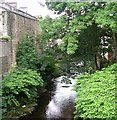
River Holme - Towngate
Image: © Betty Longbottom
Taken: 20 Jul 2007
0.05 miles
2
The river bridge at Victoria Square, Holmfirth
The bridge has been widened using a concrete slab. Underneath, on the left, is the outfall of the River Ribble, which is culverted under Barclays Bank.
Image: © Humphrey Bolton
Taken: 6 Mar 2008
0.05 miles
3
Dunford Road, Holmfirth (Cartworth township)
The old road (South lane) climbs steeply to the left, whilst the turnpike road of c.1823 takes an easier route. An old town well is built into the retaining wall. The Shoulder of Mutton on the right is one of at least three old inns in the small area south of Victoria Square. One would expect the township boundary between Wooldale and Cartworth to be the centre of the River Ribble, but it is more complicated than that, and is the face of the retaining wall opposite the pub.
Image: © Humphrey Bolton
Taken: 6 Mar 2008
0.05 miles
4
Barclays Bank, Victoria Square, Holmfirth (Wooldale)
Built over the River Ribble is a 'town' style that contrasts with the vernacular buildings on either side.
Image: © Humphrey Bolton
Taken: 6 Mar 2008
0.05 miles
5
Bridge over the River Ribble, Holmfirth (Wooldale)
This carries a narrow cobbled lane that loops round from Hollowgate to Dunford Road, passing the Rose and Crown. There is then another short open section before the river flows under Barclays Bank and joins the River Holme.
Image: © Humphrey Bolton
Taken: 6 Mar 2008
0.05 miles
6
The River Ribble, Holmfirth (Wooldale / Cartworth)
At approximately 3km long, this must be one of England's shortest rivers (ie watercourses named as a river on the OS map). Here it is near to its confluence with the River Holme, and is hemmed in by the Rose and Crown on the left and a very steep and high hillside on the right. This length of the river forms the township boundary (the lower parts of the townships amalgamated to form Holmfirth Urban Sanitary District in 1884 and then Holmfirth UDC in 1894 but the townships were civil parishes until 1921).
Image: © Humphrey Bolton
Taken: 6 Mar 2008
0.05 miles
7
The Rose and Crown, Holmfirth (Wooldale)
This has the name 'The Nook' on it but its old name is the Rose and Crown. It is a real ale pub, tucked away out-of-sight behind Barclays Bank.
Image: © Humphrey Bolton
Taken: 6 Mar 2008
0.05 miles
8
Holmfirth Town
The town originally grew up around a corn mill and bridge in the 13th century.
more at http://en.wikipedia.org/wiki/Holmfirth
Image: © Kenneth Allen
Taken: 23 Sep 2008
0.05 miles
9
Beatties Caf?, Holmfirth
It is located at Towngate
Image: © Kenneth Allen
Taken: 23 Sep 2008
0.05 miles
10
J.W.Kaye, Holmfirth
This hardware store is located at Towngate
Image: © Kenneth Allen
Taken: 23 Sep 2008
0.05 miles


