Dunford Road, Holmfirth (Cartworth township)
Introduction
The photograph on this page of Dunford Road, Holmfirth (Cartworth township) by Humphrey Bolton as part of the Geograph project.
The Geograph project started in 2005 with the aim of publishing, organising and preserving representative images for every square kilometre of Great Britain, Ireland and the Isle of Man.

There are currently over 7.5m images from over 14,400 individuals and you can help contribute to the project by visiting https://www.geograph.org.uk
Dunford Road, Holmfirth (Cartworth township)
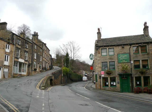
Image: © Humphrey Bolton Taken: 6 Mar 2008
The old road (South lane) climbs steeply to the left, whilst the turnpike road of c.1823 takes an easier route. An old town well is built into the retaining wall. The Shoulder of Mutton on the right is one of at least three old inns in the small area south of Victoria Square. One would expect the township boundary between Wooldale and Cartworth to be the centre of the River Ribble, but it is more complicated than that, and is the face of the retaining wall opposite the pub.
Images are licensed for reuse under creativecommons.org/licenses/by-sa/2.0
Image Location


Leaflet Map data © OpenStreetMap
Latitude
53.569318
Longitude
-1.787055