IMAGES TAKEN NEAR TO
Reservoir Side Road, HUDDERSFIELD, HD7 5JW
Introduction
This page details the photographs taken nearby to Reservoir Side Road, HD7 5JW by members of the Geograph project.
The Geograph project started in 2005 with the aim of publishing, organising and preserving representative images for every square kilometre of Great Britain, Ireland and the Isle of Man.

There are currently over 7.5m images from over14,400 individuals and you can help contribute to the project by visiting https://www.geograph.org.uk
Image Map (Loading...)


Getting Data...Please wait
Leaflet Map data © OpenStreetMap
Images are licensed for reuse under creativecommons.org/licenses/by-sa/2.0
Notes
- Clicking on the map will re-center to the selected point.
- The higher the marker number, the further away the image location is from the centre of the postcode.
Image Listing (13 Images Found)
Images are licensed for reuse under creativecommons.org/licenses/by-sa/2.0
Image
Details
Distance
1
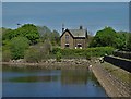
At Blackmoorfoot Reservoir
Looking to a former water board house.
Image: © Neil Theasby
Taken: 14 May 2019
0.05 miles
2
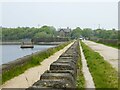
The permissive walk by Blackmoorfoot Reservoir
Along the top of the south eastern dam with the sluice tower and Reservoir House ahead
Image: © Kevin Waterhouse
Taken: 12 May 2024
0.10 miles
3
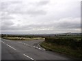
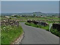
Whitehead Lane, South Crosland
Whitehead Lane is the one forking to the right. The area of grass at the junction is the last remnant of Edge Moor; the wall on the right is evidently not as old as it looks, as even the OS map of 1999 shows the road as being unfenced (or were they a bit behind with their revisions?). The Jubilee Tower on Castle Hill is on the horizon.
Image: © Humphrey Bolton
Taken: 11 Nov 2005
0.18 miles
4
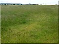
Grassy field west of Arborary Lane
A sea of green.
Image: © Christine Johnstone
Taken: 28 Jun 2011
0.19 miles
5
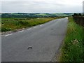
Whitehead Lane
In the distance you can see one of the main local landmarks - Castle Hill which overlooks Huddersfield like a shepherd guarding his flock.
Image: © Neil Theasby
Taken: 14 May 2019
0.20 miles
6
Arborary Lane
Looking south towards Meltham.
Image: © Christine Johnstone
Taken: 28 Jun 2011
0.21 miles
7
Harrison Lane at the junction with a track
The track is a public footpath along Crosland Edge.
Image: © Humphrey Bolton
Taken: 16 Jun 2014
0.23 miles
8
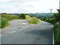
Whitehead Lane
Very wet after a heavy shower with barely a cloud in the sky. Castle Hill in the far distance
Image: © John Slater
Taken: 17 Nov 2012
0.23 miles
9
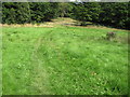
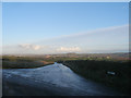
Footpath towards Blackmoorfoot Reservoir
Image: © Chris Wimbush
Taken: 15 Aug 2010
0.24 miles
10
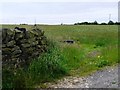
Long straight drystone wall
West of Arborary Lane.
Image: © Christine Johnstone
Taken: 28 Jun 2011
0.24 miles