Whitehead Lane, South Crosland
Introduction
The photograph on this page of Whitehead Lane, South Crosland by Humphrey Bolton as part of the Geograph project.
The Geograph project started in 2005 with the aim of publishing, organising and preserving representative images for every square kilometre of Great Britain, Ireland and the Isle of Man.

There are currently over 7.5m images from over 14,400 individuals and you can help contribute to the project by visiting https://www.geograph.org.uk
Whitehead Lane, South Crosland
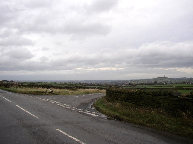
Image: © Humphrey Bolton Taken: 11 Nov 2005
Whitehead Lane is the one forking to the right. The area of grass at the junction is the last remnant of Edge Moor; the wall on the right is evidently not as old as it looks, as even the OS map of 1999 shows the road as being unfenced (or were they a bit behind with their revisions?). The Jubilee Tower on Castle Hill is on the horizon.
Images are licensed for reuse under creativecommons.org/licenses/by-sa/2.0
Image Location


Leaflet Map data © OpenStreetMap
Latitude
53.608951
Longitude
-1.841266