IMAGES TAKEN NEAR TO
Fieldway Rise, HD4 7FH
Introduction
This page details the photographs taken nearby to Fieldway Rise, HD4 7FH by members of the Geograph project.
The Geograph project started in 2005 with the aim of publishing, organising and preserving representative images for every square kilometre of Great Britain, Ireland and the Isle of Man.

There are currently over 7.5m images from over14,400 individuals and you can help contribute to the project by visiting https://www.geograph.org.uk
Image Map
Images are licensed for reuse under creativecommons.org/licenses/by-sa/2.0
Notes
- Clicking on the map will re-center to the selected point.
- The higher the marker number, the further away the image location is from the centre of the postcode.
Image Listing (20 Images Found)
Images are licensed for reuse under creativecommons.org/licenses/by-sa/2.0
Image
Details
Distance

4
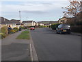
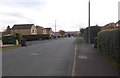
Falconers Ride - Netherton Moor Road
Image: © Betty Longbottom
Taken: 2 Nov 2016
0.12 miles
5
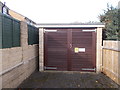
Electricity Substation No 3014 - Falconers Ride
Image: © Betty Longbottom
Taken: 2 Nov 2016
0.13 miles
6
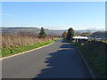
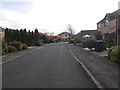
Netherton Moor Road - viewed from Coppice Avenue
Image: © Betty Longbottom
Taken: 2 Nov 2016
0.14 miles
8
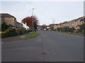
Netherton Moor Road - viewed from Coppice Avenue
Image: © Betty Longbottom
Taken: 2 Nov 2016
0.16 miles
10
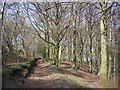
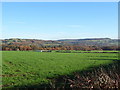
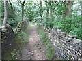
Mag Wood
Woodland near Mag Dale on the Holme Valley Circular Walk.
Image: © John Illingworth
Taken: 9 Apr 2011
0.16 miles