IMAGES TAKEN NEAR TO
Thornfield Avenue, HUDDERSFIELD, HD4 5HG
Introduction
This page details the photographs taken nearby to Thornfield Avenue, HD4 5HG by members of the Geograph project.
The Geograph project started in 2005 with the aim of publishing, organising and preserving representative images for every square kilometre of Great Britain, Ireland and the Isle of Man.

There are currently over 7.5m images from over14,400 individuals and you can help contribute to the project by visiting https://www.geograph.org.uk
Image Map
Images are licensed for reuse under creativecommons.org/licenses/by-sa/2.0
Notes
- Clicking on the map will re-center to the selected point.
- The higher the marker number, the further away the image location is from the centre of the postcode.
Image Listing (135 Images Found)
Images are licensed for reuse under creativecommons.org/licenses/by-sa/2.0
Image
Details
Distance
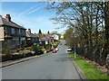
1
Thornfield Road from Thoirnfield Avenue
This was taken from the top of the Howarth Lane footpath.
Image: © Humphrey Bolton
Taken: 25 Mar 2015
0.03 miles
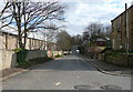
2
The Howarth Lane footpath from Thornfield Road
Image: © Humphrey Bolton
Taken: 25 Mar 2015
0.04 miles
3
Thornfield Avenue from Moor End Road
Image: © Humphrey Bolton
Taken: 25 Mar 2015
0.04 miles
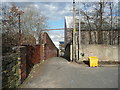
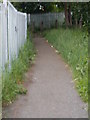
5
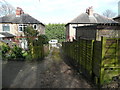
Passage off Thornfield Road
This is looking towards the road from the edge of the wooded area. There were lockup garages here but most, if not all, of them have gone now.
Image: © Humphrey Bolton
Taken: 25 Mar 2015
0.05 miles
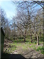
6
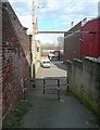
The Howarth Lane footpath
Howarth was in the length of road beyond the barrier. It was probably a farm, but is shown as a small group of houses on the 1890 1:500 map. They were hemmed in by a railway wagon works and Prospect Iron Works, and were eventually demolished.
Image: © Humphrey Bolton
Taken: 25 Mar 2015
0.05 miles
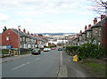
7
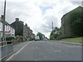
Moor End Road - viewed from Walpole Road
Image: © Betty Longbottom
Taken: 5 Jul 2010
0.06 miles
9
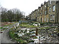
Dereliction, Back Moor End Road, Lockwood
The 1:1250 map of the early 1970s suggests that some of the rear ground floor of the terrace were under-dwellings, whilst some were basements of the house above. It looks as if the derelict land belongs mainly to the under-dwellings that have been boarded-up.
Image: © Humphrey Bolton
Taken: 25 Mar 2015
0.07 miles