IMAGES TAKEN NEAR TO
Chapel Terrace, HUDDERSFIELD, HD4 5DZ
Introduction
This page details the photographs taken nearby to Chapel Terrace, HD4 5DZ by members of the Geograph project.
The Geograph project started in 2005 with the aim of publishing, organising and preserving representative images for every square kilometre of Great Britain, Ireland and the Isle of Man.

There are currently over 7.5m images from over14,400 individuals and you can help contribute to the project by visiting https://www.geograph.org.uk
Image Map
Images are licensed for reuse under creativecommons.org/licenses/by-sa/2.0
Notes
- Clicking on the map will re-center to the selected point.
- The higher the marker number, the further away the image location is from the centre of the postcode.
Image Listing (85 Images Found)
Images are licensed for reuse under creativecommons.org/licenses/by-sa/2.0
Image
Details
Distance
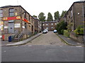
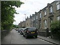
2
Blackmoorfoot Road, North Crosland, Lockwood
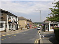
This was the first turnpike road from Huddersfield to Manchester. It was part of a road from Wakefield Road to Austerlands (at the county boundary) authorised in 1758. The road climbed relentlessly from Longroyd Bridge to a summit near Blackmoorfoot, and then dropped down to Marsden. As the Colne Valley became industrialised this route became unsatisfactory and the present A62 road was built c.1820. The pub is the Craven Heifer.
Image: © Humphrey Bolton
Taken: 19 Jul 2007
0.04 miles
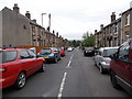
5
Chapel Terrace - Blackmoorfoot Road
Image: © Betty Longbottom
Taken: 5 Jul 2010
0.05 miles
6
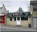
Kadri Takeaway - Blackmoorfoot Road
Image: © Betty Longbottom
Taken: 5 Jul 2010
0.06 miles
8
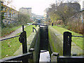
Huddersfield Canal east of Milnsbridge
Looking west along the Huddersfield Narrow Canal at Lock 7e, east of Milnsbridge.
Image: © Martin Clark
Taken: Unknown
0.07 miles
9
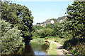
Huddersfield Narrow Canal near Lockwood
Image: © Andy Stephenson
Taken: 16 Jul 2005
0.07 miles
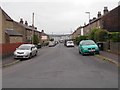
10
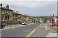
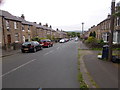
Blackmoorfoot Road, Crosland Moor, North Crosland, Lockwood
On the right is the entrance to St Luke's Hospital, and the bus shelter is no doubt well-used.
Image: © Humphrey Bolton
Taken: 19 Jul 2007
0.07 miles