IMAGES TAKEN NEAR TO
Cross Street, HUDDERSFIELD, HD4 5AY
Introduction
This page details the photographs taken nearby to Cross Street, HD4 5AY by members of the Geograph project.
The Geograph project started in 2005 with the aim of publishing, organising and preserving representative images for every square kilometre of Great Britain, Ireland and the Isle of Man.

There are currently over 7.5m images from over14,400 individuals and you can help contribute to the project by visiting https://www.geograph.org.uk
Image Map
Images are licensed for reuse under creativecommons.org/licenses/by-sa/2.0
Notes
- Clicking on the map will re-center to the selected point.
- The higher the marker number, the further away the image location is from the centre of the postcode.
Image Listing (151 Images Found)
Images are licensed for reuse under creativecommons.org/licenses/by-sa/2.0
Image
Details
Distance
1
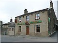
Griffin Lodge, Manchester Road A62, Thornton Lodge, Lockwood
Formerly the Griffin Inn. The house on the left was the lodge for a big house called Thornton Lodge, which has given its name to the district.
Image: © Humphrey Bolton
Taken: 3 Apr 2008
0.04 miles
4
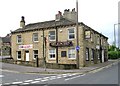
Manchester Road approach to Huddersfield
Birkhouse Lane seen on the left
Image: © Raymond Knapman
Taken: 11 Apr 2014
0.05 miles
5
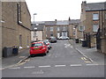
Electricity Substation No 48559 - Blackmoorfoot Road
Image: © Betty Longbottom
Taken: 17 May 2016
0.06 miles
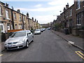
9
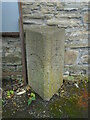
Old milestone
On the A62, Manchester Road, just west of the railway viaduct. One of about 30 original stones set up by the Town Watch Committee on many roads leading out of Huddersfield. These stones were to regulate the Hansom Cab Fare-stages. This one was defaced but is a 1 mile stone. Left face- FROM/HUDD/(HUDDERSFIELD)/(1)/MILE.
Right face - FROM/HUDD/(HUDDERSFIELD)/(1)/MILE. The smaller HUDD on each face is a later addition.
Image: © Chris Minto
Taken: 16 Jul 2023
0.07 miles
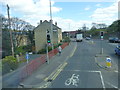
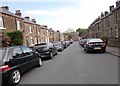
10
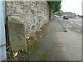
Old milestone
The milestone near the railway viaduct over the A62 which leads off to the right. The red car is on Blackmoorfoot Road. On all the similar stones 'HUDDERSFIELD' is always curved.
Image: © Chris Minto
Taken: 16 Jul 2023
0.07 miles