IMAGES TAKEN NEAR TO
Broomroyd, HUDDERSFIELD, HD3 4RS

Introduction

This page details the photographs taken nearby to Broomroyd, HD3 4RS by members of the Geograph project.

The Geograph project started in 2005 with the aim of publishing, organising and preserving representative images for every square kilometre of Great Britain, Ireland and the Isle of Man.

There are currently over 7.5m images from over14,400 individuals and you can help contribute to the project by visiting https://www.geograph.org.uk

Image Map


Images are licensed for reuse under creativecommons.org/licenses/by-sa/2.0
Notes
  • Clicking on the map will re-center to the selected point.
  • The higher the marker number, the further away the image location is from the centre of the postcode.

Image Listing (104 Images Found)

Images are licensed for reuse under creativecommons.org/licenses/by-sa/2.0
  • ...
Image
Details
Distance
1
Wood Street - viewed from Side Lane
Image: © Betty Longbottom Taken: 29 Dec 2015
0.03 miles
2
Side Lane - Wood Street
Image: © Betty Longbottom Taken: 29 Dec 2015
0.03 miles
3
Site of mill, Benn Lane, Longwood
Hard now to believe that this scene was once tall buildings; see Image for the end of that era. Similar sites nearby have been redeveloped with town houses.
Image: © Humphrey Bolton Taken: 8 Jul 2008
0.05 miles
4
Electricity Substation No 1677 - Botham Hall Road
Image: © Betty Longbottom Taken: 29 Dec 2015
0.06 miles
5
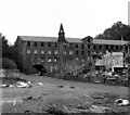
Derelict woollen mill, Longwood, near Huddersfield
This was Sunnybank Mill, owned by C. and J. Hirst. The road which is bridged over by the building is the bottom end of Grove Street: and the road coming down from the left at the extreme left end of the mill is Benn Lane. It appears that the mill was listed, but the arched part collapsed spontaneously so the whole structure was demolished. I am indebted to Chris Allen for this information. Further information from Conrad Diamond informs me that the collapse was actually caused by a skip-wagon hitting the arch.
Image: © Dr Neil Clifton Taken: 30 Oct 1985
0.06 miles
6
Wood Street
Image: © Alexander P Kapp Taken: 27 Aug 2009
0.07 miles
7
Orchard Court - Side Lane
Image: © Betty Longbottom Taken: 29 Dec 2015
0.08 miles
8
Sunnybank Mills hit the dust.
A large complex of woollen mills in Longwood was being demolished on a less than sparkling day. I was able to walk right through the middle of the demolition site - try that in 2008. The chimney looks a little wonky. The dead straight chimney in the distance is Joseph Hoyle's Prospect Mills. That is now also gone. Humphrey Bolton has photographed this area in the post-mill era.
Image: © Chris Allen Taken: 30 May 1983
0.08 miles
9
The demolition of Sunnybank Mills, Longwood
This is from practically the same spot as one of Humphrey Bolton's picturesImage The area to the left is houses and to the right there's woodland. This was one of many mills that filled the road out from Milnsbridge.
Image: © Chris Allen Taken: 30 May 1983
0.08 miles
10
Mill building, Dale Street, Longwood
The Longwood valley had a long string of mill buildings of which few are still in use, this one having been adapted for the sale of 'white goods'.
Image: © Humphrey Bolton Taken: 8 Jul 2008
0.08 miles
  • ...