The demolition of Sunnybank Mills, Longwood
Introduction
The photograph on this page of The demolition of Sunnybank Mills, Longwood by Chris Allen as part of the Geograph project.
The Geograph project started in 2005 with the aim of publishing, organising and preserving representative images for every square kilometre of Great Britain, Ireland and the Isle of Man.

There are currently over 7.5m images from over 14,400 individuals and you can help contribute to the project by visiting https://www.geograph.org.uk
The demolition of Sunnybank Mills, Longwood
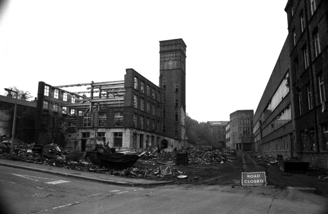
Image: © Chris Allen Taken: 30 May 1983
This is from practically the same spot as one of Humphrey Bolton's picturesImage The area to the left is houses and to the right there's woodland. This was one of many mills that filled the road out from Milnsbridge.
Images are licensed for reuse under creativecommons.org/licenses/by-sa/2.0
Image Location
Latitude
53.646155
Longitude
-1.835983