IMAGES TAKEN NEAR TO
Cowrakes Road, HUDDERSFIELD, HD3 3SS
Introduction
This page details the photographs taken nearby to Cowrakes Road, HD3 3SS by members of the Geograph project.
The Geograph project started in 2005 with the aim of publishing, organising and preserving representative images for every square kilometre of Great Britain, Ireland and the Isle of Man.

There are currently over 7.5m images from over14,400 individuals and you can help contribute to the project by visiting https://www.geograph.org.uk
Image Map
Images are licensed for reuse under creativecommons.org/licenses/by-sa/2.0
Notes
- Clicking on the map will re-center to the selected point.
- The higher the marker number, the further away the image location is from the centre of the postcode.
Image Listing (55 Images Found)
Images are licensed for reuse under creativecommons.org/licenses/by-sa/2.0
Image
Details
Distance
1
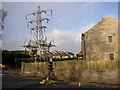
Pylon, Cowrakes Road, Lindley
At this pylon the overhead cables end and continue underground.
Image: © Humphrey Bolton
Taken: 3 Dec 2006
0.03 miles
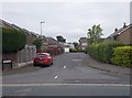
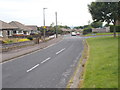
5
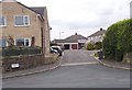
Cowrakes Road - viewed from Crosland Road
Image: © Betty Longbottom
Taken: 16 Jun 2015
0.05 miles
6
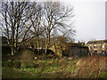
Outbuilding in field off Cowrakes Road, Lindley
This field was perhaps a smallholding, part of a hamlet called Cowrakes.
Image: © Humphrey Bolton
Taken: 3 Dec 2006
0.05 miles
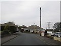
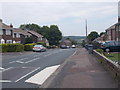
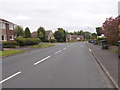
7
Crosland Road - viewed from Moor Hill Road
Image: © Betty Longbottom
Taken: 16 Jun 2015
0.06 miles
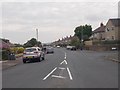
9
Crosland Road - viewed from Moor Hill Road
Image: © Betty Longbottom
Taken: 16 Jun 2015
0.07 miles