IMAGES TAKEN NEAR TO
Bulay Road, HUDDERSFIELD, HD1 3NH
Introduction
This page details the photographs taken nearby to Bulay Road, HD1 3NH by members of the Geograph project.
The Geograph project started in 2005 with the aim of publishing, organising and preserving representative images for every square kilometre of Great Britain, Ireland and the Isle of Man.

There are currently over 7.5m images from over14,400 individuals and you can help contribute to the project by visiting https://www.geograph.org.uk
Image Map
Images are licensed for reuse under creativecommons.org/licenses/by-sa/2.0
Notes
- Clicking on the map will re-center to the selected point.
- The higher the marker number, the further away the image location is from the centre of the postcode.
Image Listing (176 Images Found)
Images are licensed for reuse under creativecommons.org/licenses/by-sa/2.0
Image
Details
Distance
1
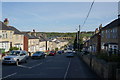
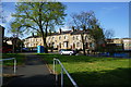
Springfield Avenue at Nelson Street, Huddersfield
Image: © Ian S
Taken: 8 May 2015
0.04 miles
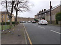
2
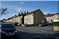
Springfield Avenue at Springfield Street, Huddersfield
Image: © Ian S
Taken: 8 May 2015
0.05 miles
3
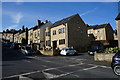
Springfield Avenue at Nelson Street, Huddersfield
Image: © Ian S
Taken: 8 May 2015
0.06 miles
4
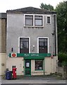
Longroyd Bridge Post Office - St Thomas' Road
Image: © Betty Longbottom
Taken: 8 Aug 2008
0.07 miles
6
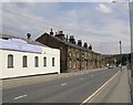
St Thomas's Road, North Crosland, Lockwood
This is a 19C road made to open up this flat riverside land for industry. Two blocks of back-to-back houses were built, of which one survives. The OS now omit the final 's' of the street name, but retain the apostrophe; that is of course incorrect. The 1907 map correctly shows 'Thomas's'.
Image: © Humphrey Bolton
Taken: 19 Jul 2007
0.08 miles
8
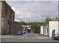
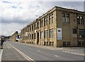
Graham Street, North Crosland, Lockwood
One of a series of streets serving the industrial area off St Thomas's Road. This land was developed after 1907, at which time there were allotments here. The building on the left was 'Empress Works' c.1940.
Image: © Humphrey Bolton
Taken: 19 Jul 2007
0.10 miles
9
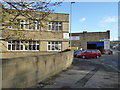
Empress Works, St Thomas's Road, North Crosland, Lockwood
Now divided into units, some evidently vacant.
Image: © Humphrey Bolton
Taken: 19 Jul 2007
0.10 miles
10
Fireplace World and Fired Up, Huddersfield
This is a former bus depot dating back to 1921 in the days of the trams and then the trolley buses before they were usurped by motor buses in 1968. Before the garage was built there had been a tramway power station here.
Image: © Chris Allen
Taken: 2 Nov 2017
0.10 miles