IMAGES TAKEN NEAR TO
North End Road, WEMBLEY, HA9 0AH
Introduction
This page details the photographs taken nearby to North End Road, HA9 0AH by members of the Geograph project.
The Geograph project started in 2005 with the aim of publishing, organising and preserving representative images for every square kilometre of Great Britain, Ireland and the Isle of Man.

There are currently over 7.5m images from over14,400 individuals and you can help contribute to the project by visiting https://www.geograph.org.uk
Image Map
Images are licensed for reuse under creativecommons.org/licenses/by-sa/2.0
Notes
- Clicking on the map will re-center to the selected point.
- The higher the marker number, the further away the image location is from the centre of the postcode.
Image Listing (188 Images Found)
Images are licensed for reuse under creativecommons.org/licenses/by-sa/2.0
Image
Details
Distance
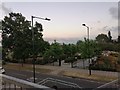
2
The Wembley Stadium complex by the Chalkhill Estate
Image: © David Howard
Taken: 18 Jun 2020
0.06 miles
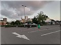
3
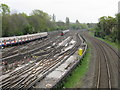
Tube and train tracks east of Wembley Park station
On the left a Metropolitan line service heads south while a northbound Jubilee line train awaits a clear platform. On the extreme right are the main line tracks from London Marylebone to Aylesbury.
Image: © Peter Whatley
Taken: 11 Apr 2011
0.07 miles
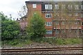
4
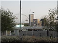
Tower blocks by Wembley Stadium
From the Asda car park
Image: © David Howard
Taken: 15 Jul 2018
0.07 miles