IMAGES TAKEN NEAR TO
St. Margarets Road, EDGWARE, HA8 9UR
Introduction
This page details the photographs taken nearby to St. Margarets Road, HA8 9UR by members of the Geograph project.
The Geograph project started in 2005 with the aim of publishing, organising and preserving representative images for every square kilometre of Great Britain, Ireland and the Isle of Man.

There are currently over 7.5m images from over14,400 individuals and you can help contribute to the project by visiting https://www.geograph.org.uk
Image Map
Images are licensed for reuse under creativecommons.org/licenses/by-sa/2.0
Notes
- Clicking on the map will re-center to the selected point.
- The higher the marker number, the further away the image location is from the centre of the postcode.
Image Listing (155 Images Found)
Images are licensed for reuse under creativecommons.org/licenses/by-sa/2.0
Image
Details
Distance
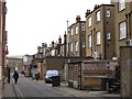
1
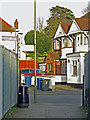
Bakery Path
Looking into Brook Avenue. The other end of the somewhat tortuous path (behind me) is on Station Road - see Image
Image: © Mike Quinn
Taken: 26 Feb 2020
0.02 miles
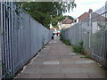
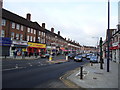
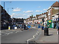
3
Brook Avenue / St. Margarets Road
Short of an apostrophe.
Image: © Mike Quinn
Taken: 26 Feb 2020
0.03 miles
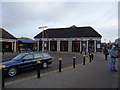
4
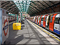
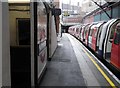
Edgware Station
The northern end of the Edgware Branch of the Northern Line. The station opened in 1924 and was designed by Stanley Heaps. The extension of the line from Golders Green spurred rapid suburban growth in the areas beside the line. Plans in 1935 to extend the railway beyond Edgware to Bushey Heath were abandoned with the introduction of Green Belt legislation after the Second World War.
Image: © Martin Addison
Taken: 6 Apr 2010
0.05 miles
5
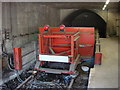
End of the Northern Line, Edgware tube station
An image of the bufferstops at Edgware tube station showing the tunnelmouth which was planned to accept tracks taking the line 5 kilometres northwest of this station to a new terminus at Bushey Heath. Construction on the new line to Bushey Heath began in the late 1930s but were halted by the outbreak of the Second World War. After the war, Green Belt legislation was introduced to limit the outward expansion of urban areas into the surrounding countryside. The area through which the new Bushey Heath extension was routed was designated as Green Belt meaning that the planned residential developments were prevented and the need for the stations serving them was removed. The completion of the plans to extend the Northern line were formally cancelled in 1950.
Image: © Oxyman
Taken: 26 Apr 2009
0.05 miles
6
End of the Northern Line, Edgware Underground Station
Image: © Robin Sones
Taken: 17 Sep 2014
0.05 miles