IMAGES TAKEN NEAR TO
St. Margarets Road, EDGWARE, HA8 9UP
Introduction
This page details the photographs taken nearby to St. Margarets Road, HA8 9UP by members of the Geograph project.
The Geograph project started in 2005 with the aim of publishing, organising and preserving representative images for every square kilometre of Great Britain, Ireland and the Isle of Man.

There are currently over 7.5m images from over14,400 individuals and you can help contribute to the project by visiting https://www.geograph.org.uk
Image Map
Images are licensed for reuse under creativecommons.org/licenses/by-sa/2.0
Notes
- Clicking on the map will re-center to the selected point.
- The higher the marker number, the further away the image location is from the centre of the postcode.
Image Listing (146 Images Found)
Images are licensed for reuse under creativecommons.org/licenses/by-sa/2.0
Image
Details
Distance
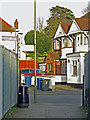
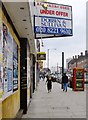
1
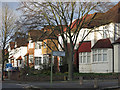
Brook Avenue / St. Margarets Road
Short of an apostrophe.
Image: © Mike Quinn
Taken: 26 Feb 2020
0.02 miles
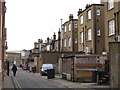
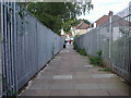
6
Bakery Path
Looking into Brook Avenue. The other end of the somewhat tortuous path (behind me) is on Station Road - see Image
Image: © Mike Quinn
Taken: 26 Feb 2020
0.06 miles
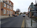
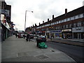
9
Station Road, Edgware
Looking south from near the junction with Penshurst Gardens.
Image: © Stefan Czapski
Taken: 19 May 2013
0.06 miles
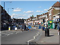
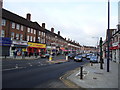
10
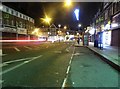
Station Road, Edgware
Looking towards the junction with Edgwarebury Lane. The only time when it's quiet.
Image: © David Howard
Taken: 4 Dec 2014
0.06 miles