IMAGES TAKEN NEAR TO
Riverdene, EDGWARE, HA8 9TD
Introduction
This page details the photographs taken nearby to Riverdene, HA8 9TD by members of the Geograph project.
The Geograph project started in 2005 with the aim of publishing, organising and preserving representative images for every square kilometre of Great Britain, Ireland and the Isle of Man.

There are currently over 7.5m images from over14,400 individuals and you can help contribute to the project by visiting https://www.geograph.org.uk
Image Map
Images are licensed for reuse under creativecommons.org/licenses/by-sa/2.0
Notes
- Clicking on the map will re-center to the selected point.
- The higher the marker number, the further away the image location is from the centre of the postcode.
Image Listing (27 Images Found)
Images are licensed for reuse under creativecommons.org/licenses/by-sa/2.0
Image
Details
Distance
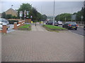
1
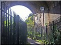
Path under the railway leading to Stoneyfields Park
Image: © David Howard
Taken: 8 Oct 2008
0.12 miles
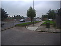
2
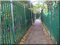
Footpath from The Fairway to Stoneyfields Park
Going under the M1 Motorway and railway lines first.
Image: © David Howard
Taken: 8 Oct 2008
0.14 miles
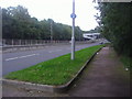
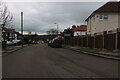
5
The A41 at the end of Oakfield Gardens
You can walk through but you can't drive.
Image: © David Howard
Taken: 2 Oct 2013
0.19 miles
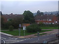
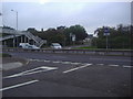
8
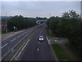
The A41 Edgware
Heading back towards Mill Hill and Hendon
Image: © David Howard
Taken: 2 Oct 2013
0.19 miles