IMAGES TAKEN NEAR TO
Oakwood Drive, EDGWARE, HA8 9LF
Introduction
This page details the photographs taken nearby to Oakwood Drive, HA8 9LF by members of the Geograph project.
The Geograph project started in 2005 with the aim of publishing, organising and preserving representative images for every square kilometre of Great Britain, Ireland and the Isle of Man.

There are currently over 7.5m images from over14,400 individuals and you can help contribute to the project by visiting https://www.geograph.org.uk
Image Map
Images are licensed for reuse under creativecommons.org/licenses/by-sa/2.0
Notes
- Clicking on the map will re-center to the selected point.
- The higher the marker number, the further away the image location is from the centre of the postcode.
Image Listing (65 Images Found)
Images are licensed for reuse under creativecommons.org/licenses/by-sa/2.0
Image
Details
Distance
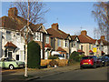
1
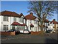
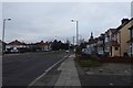
West Way
The north side, east of Oakwood Drive.
Image: © Mike Quinn
Taken: 26 Feb 2020
0.06 miles
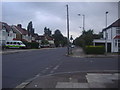
6
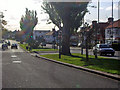
Dean's Lane
Looking along a road through part of Edgware.
Image: © DS Pugh
Taken: 31 Dec 2018
0.10 miles
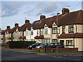
8
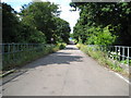
Edgware: Former Great Northern Railway branch line
This is the trackbed of the former railway looking from the other side of Dean's Lane to Image, (which gives a brief history of the line), down and over Dean's Brook and towards the former terminus at Edgware. To add insult to injury the route is now in use as the access road to London Underground's Edgware Depot.
Image: © Nigel Cox
Taken: 25 Jul 2009
0.15 miles
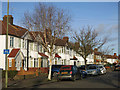
10
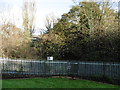
This was once going to be part of the Northern line
Seen from Dean's Lane the track ahead which is now a nature reserve was once going to be a part of the Northern line.
The line between what is now Finsbury Park and Edgware was opened by the Great Northern Railway on the 22nd August 1867. In the London Passenger Transport Board's 'New Works Plan' of 1935 it was proposed that the line be taken over by the Northern line and be diverted into the new Underground station at Edgware which had opened in 1924. The service on the line from East Finchley to Edgware was suspended from 11th September 1939 to allow the work to be completed and the New Works Plan was expected to be completed by spring 1941. In the event the Northern line branch never got past Mill Hill East and so 11th September 1939 was the last day the line was used by passenger trains. The line was closed completely on 1st June 1964.
For a full history of this line and photographs showing how the Northern line would have been extended beyond Edgware to Bushey Heath see http://www.disused-stations.org.uk/e/edgware/ and http://www.abandonedstations.org.uk/Northern_Heights_9.html and http://www.abandonedstations.org.uk/Northern_Heights_10.html
Image: © Marathon
Taken: 25 Nov 2015
0.15 miles