IMAGES TAKEN NEAR TO
Turner Road, EDGWARE, HA8 6BH
Introduction
This page details the photographs taken nearby to Turner Road, HA8 6BH by members of the Geograph project.
The Geograph project started in 2005 with the aim of publishing, organising and preserving representative images for every square kilometre of Great Britain, Ireland and the Isle of Man.

There are currently over 7.5m images from over14,400 individuals and you can help contribute to the project by visiting https://www.geograph.org.uk
Image Map
Images are licensed for reuse under creativecommons.org/licenses/by-sa/2.0
Notes
- Clicking on the map will re-center to the selected point.
- The higher the marker number, the further away the image location is from the centre of the postcode.
Image Listing (22 Images Found)
Images are licensed for reuse under creativecommons.org/licenses/by-sa/2.0
Image
Details
Distance
2
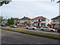
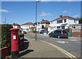
Bridgewater Gardens, Edgware
At the entrance to Canons High School
Image: © David Howard
Taken: 28 Jan 2015
0.13 miles
3
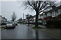
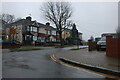
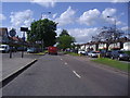
Edgware: Camrose Avenue
Viewed looking north eastwards from the junction with Turner Road.
Image: © Nigel Cox
Taken: 17 Dec 2005
0.15 miles
4
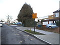
Shaldon Road at the junction of Bridgewater Gardens
Canons High School is on the right
Image: © David Howard
Taken: 13 Jan 2021
0.18 miles
5
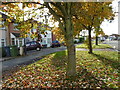
Autumn leaves along Mollison Way
The name of Queensbury was the winner of a competition run by a Golders Green estate agent (Percy H Edwards) to come up with a title for the new district to the north of Kingsbury. Traffic on the railway grew only slowly, possibly because the Metropolitan charged main line fares. People found it cheaper to go to Edgware by bus and take the Hampstead Tube. Queensbury was the most rapidly- developed estate in north-west London. The landscape was largely flat and devoid of natural features.
For more about the station see http://www.geograph.org.uk/photo/4719174
The late October sun catches the leaves along the pavement of Mollison Way in Queensbury.
Image: © Marathon
Taken: 28 Oct 2015
0.20 miles
7
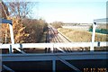
Jubilee Line railway between Queensbury and Canons Park
Viewed looking northwards from the Taunton Way / Camrose Avenue overbridge with a southbound train approaching. The gantry in the foreground supports a pipe crossing the railway.
Image: © Nigel Cox
Taken: 17 Dec 2005
0.20 miles
9
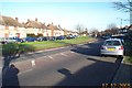
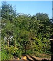
Collins Avenue, 64 metres aod
Just a random bit of information, the map shows a spot height of 64 metres more or less where I'm standing.
Image: © Des Blenkinsopp
Taken: 4 Sep 2019
0.20 miles