IMAGES TAKEN NEAR TO
Brockley Avenue, STANMORE, HA7 4LT
Introduction
This page details the photographs taken nearby to Brockley Avenue, HA7 4LT by members of the Geograph project.
The Geograph project started in 2005 with the aim of publishing, organising and preserving representative images for every square kilometre of Great Britain, Ireland and the Isle of Man.

There are currently over 7.5m images from over14,400 individuals and you can help contribute to the project by visiting https://www.geograph.org.uk
Image Map
Images are licensed for reuse under creativecommons.org/licenses/by-sa/2.0
Notes
- Clicking on the map will re-center to the selected point.
- The higher the marker number, the further away the image location is from the centre of the postcode.
Image Listing (29 Images Found)
Images are licensed for reuse under creativecommons.org/licenses/by-sa/2.0
Image
Details
Distance
1
Path at end of Pipers Green Lane, Edgware
Image: © David Howard
Taken: 31 Jan 2008
0.05 miles
6
Pipers Green Lane, Edgware 1994
This was originally part of Green Lane to the south but was divided some time around the 1960s and is now reduced to a footpath for the linking part. Grantham Close is on the left.
Image: © David Howard
Taken: Unknown
0.12 miles
7
Edgwarebury Golf Course, Edgware
The old 9 hole course has now been split with the crazy golf.
Image: © David Howard
Taken: 7 May 2020
0.13 miles
8
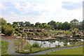
Edgwarebury Golf Course, Edgware
After many years derelict it has reopened with the world's largest crazy golf course, and the 9 hole course tucked away behind it.
Image: © David Howard
Taken: 7 May 2020
0.14 miles
9
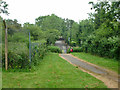
Path to A5
In a small open space, apparently mainly for those in the housing development to the south.
Image: © Robin Webster
Taken: 14 Jun 2015
0.14 miles