IMAGES TAKEN NEAR TO
Greenacres Drive, STANMORE, HA7 3QJ
Introduction
This page details the photographs taken nearby to Greenacres Drive, HA7 3QJ by members of the Geograph project.
The Geograph project started in 2005 with the aim of publishing, organising and preserving representative images for every square kilometre of Great Britain, Ireland and the Isle of Man.

There are currently over 7.5m images from over14,400 individuals and you can help contribute to the project by visiting https://www.geograph.org.uk
Image Map
Images are licensed for reuse under creativecommons.org/licenses/by-sa/2.0
Notes
- Clicking on the map will re-center to the selected point.
- The higher the marker number, the further away the image location is from the centre of the postcode.
Image Listing (13 Images Found)
Images are licensed for reuse under creativecommons.org/licenses/by-sa/2.0
Image
Details
Distance
2
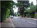
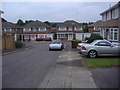
Night falls over Gordon Avenue, Stanmore
Gordon Avenue in Stanmore, photographed at 7:55 on a September evening.
Image: © Malc McDonald
Taken: 12 Sep 2015
0.11 miles
4
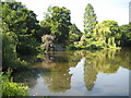
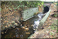
Stanmore: Temple Pond
Temple Pond was once a fish pond in the Stanmore Park estate, created by damming up the Stanburn Stream. The distant grey metal structure in the shadows is the outlet sluice.
Image: © Nigel Cox
Taken: 3 Jul 2011
0.18 miles
6
Stanburn Stream below Temple Pond
Stanburn Stream refers to the upper section of the Edgware Brook, a tributary at the top of the Brent catchment, the river which drains much of north-west London. This is just over 2 kms downstream of the source near Bentley Priory.
Image: © Des Blenkinsopp
Taken: 4 Sep 2019
0.18 miles
7
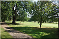
Path on the Golf Course
A private path belonging to Stanmore golf club. The public footpath runs parallel but is secluded from the course by fences and hedges for most of the way and divides the course to a great extent.. This view is through a gateway where players cross from one side to the other.
Image: © Des Blenkinsopp
Taken: 4 Sep 2019
0.20 miles
8
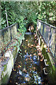
Stanburn Stream or Edgware Brook
I have seen both names in use for this upper tributary of the River Brent, so I have put both in the title.
Image: © Des Blenkinsopp
Taken: 4 Sep 2019
0.20 miles
9
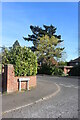
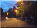
The Chase at the junction of Gordon Avenue
Image: © David Howard
Taken: 23 Apr 2021
0.23 miles
10
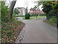
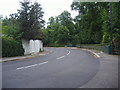
Path off Gordon Avenue
This path leads through to some new flats. Temple Pond is off to the right.
Image: © Marathon
Taken: 11 Nov 2015
0.23 miles