IMAGES TAKEN NEAR TO
Halsbury Close, STANMORE, HA7 3DX
Introduction
This page details the photographs taken nearby to Halsbury Close, HA7 3DX by members of the Geograph project.
The Geograph project started in 2005 with the aim of publishing, organising and preserving representative images for every square kilometre of Great Britain, Ireland and the Isle of Man.

There are currently over 7.5m images from over14,400 individuals and you can help contribute to the project by visiting https://www.geograph.org.uk
Image Map
Images are licensed for reuse under creativecommons.org/licenses/by-sa/2.0
Notes
- Clicking on the map will re-center to the selected point.
- The higher the marker number, the further away the image location is from the centre of the postcode.
Image Listing (116 Images Found)
Images are licensed for reuse under creativecommons.org/licenses/by-sa/2.0
Image
Details
Distance
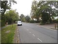
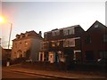
2
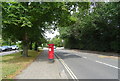
Stanmore Hill (A4140)
Showing position of Postbox No. HA7 837.
See Image] for postbox.
Image: © JThomas
Taken: 3 Aug 2019
0.04 miles
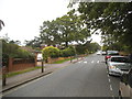
4
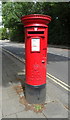
Elizabeth II postbox on Stanmore Hill
Postbox No. HA7 843.
See Image] for context.
Image: © JThomas
Taken: 3 Aug 2019
0.05 miles
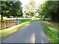
5
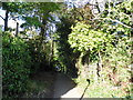
Footpath between Stanmore Hill and Eaton Close
Image: © David Howard
Taken: 27 Sep 2012
0.06 miles
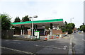
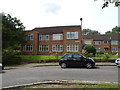
7
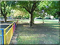
Stanmore Recreation Ground
Just off Stanmore Hill
Image: © David Howard
Taken: 27 Sep 2012
0.08 miles