IMAGES TAKEN NEAR TO
Wemborough Road, STANMORE, HA7 2EA
Introduction
This page details the photographs taken nearby to Wemborough Road, HA7 2EA by members of the Geograph project.
The Geograph project started in 2005 with the aim of publishing, organising and preserving representative images for every square kilometre of Great Britain, Ireland and the Isle of Man.

There are currently over 7.5m images from over14,400 individuals and you can help contribute to the project by visiting https://www.geograph.org.uk
Image Map
Images are licensed for reuse under creativecommons.org/licenses/by-sa/2.0
Notes
- Clicking on the map will re-center to the selected point.
- The higher the marker number, the further away the image location is from the centre of the postcode.
Image Listing (38 Images Found)
Images are licensed for reuse under creativecommons.org/licenses/by-sa/2.0
Image
Details
Distance
1
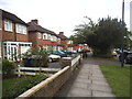
Gyles Park, Stanmore
Gyles Park is a residential road in London's outer north-western suburbs.
Image: © Malc McDonald
Taken: 12 Sep 2015
0.05 miles
2
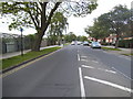
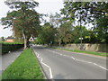
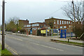
Wemborough Road, Stanmore
There was no danger of being run over as I was standing on an island here.
Image: © David Howard
Taken: 29 May 2014
0.08 miles
3
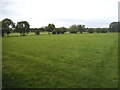
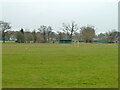
Sports ground by Abercorn Road, Stanmore
Image: © David Howard
Taken: 29 May 2014
0.11 miles
4
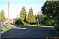
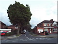
Stanmore: Bromefield
One of those pleasing little roundabouts in the middle of a suburban housing estate, serving no purpose other than to break up the straightness of the road, although this one has a short cul-de-sac leading off it. The view was taken looking north eastwards towards Wemborough Road.
Image: © Nigel Cox
Taken: 17 Dec 2005
0.11 miles
7
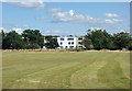
Sports Ground opposite Stanmore School
Image: © Des Blenkinsopp
Taken: 4 Sep 2019
0.13 miles
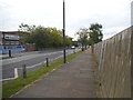
8
Whitchurch Playing Fields
Looking from Abercorn Road.
Image: © Robin Webster
Taken: 23 Feb 2013
0.13 miles
9
Stanburn Primary School
On Abercorn Road. A sign says 'Site of restored blast shelter'. A WWII structure acting as a museum for visits from other schools. Apparently distinguished from an air raid shelter (which the school also had) by being fully above ground.
Image: © Robin Webster
Taken: 23 Feb 2013
0.14 miles