IMAGES TAKEN NEAR TO
Beverley Gardens, STANMORE, HA7 2AP
Introduction
This page details the photographs taken nearby to Beverley Gardens, HA7 2AP by members of the Geograph project.
The Geograph project started in 2005 with the aim of publishing, organising and preserving representative images for every square kilometre of Great Britain, Ireland and the Isle of Man.

There are currently over 7.5m images from over14,400 individuals and you can help contribute to the project by visiting https://www.geograph.org.uk
Image Map
Images are licensed for reuse under creativecommons.org/licenses/by-sa/2.0
Notes
- Clicking on the map will re-center to the selected point.
- The higher the marker number, the further away the image location is from the centre of the postcode.
Image Listing (49 Images Found)
Images are licensed for reuse under creativecommons.org/licenses/by-sa/2.0
Image
Details
Distance
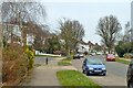
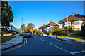
1
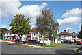
S Edmunds Drive, Belmont
Junction with Beverley Gardens.
1930s residential streets, like all this area.
Image: © Des Blenkinsopp
Taken: 4 Sep 2019
0.05 miles
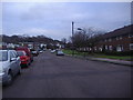
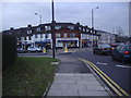
2
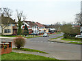
Top end of Beverley Gardens, Stanmore
Image: © Robin Webster
Taken: 23 Feb 2013
0.07 miles
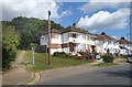
3
London Borough of Harrow : Kenton Lane
Looking along Kenton Lane.
Image: © Lewis Clarke
Taken: 3 Oct 2018
0.10 miles
4
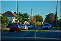
Beverley Gardens crosses Curzon Avenue
Image: © Des Blenkinsopp
Taken: 4 Sep 2019
0.10 miles
7
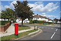
Vernon Drive, Belmont
The start of the footpath over Belmont Hill.
Image: © Des Blenkinsopp
Taken: 4 Sep 2019
0.11 miles
8
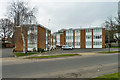
Flats on Mountside
The upper floors should have a good view to the south.
Image: © Robin Webster
Taken: 23 Feb 2013
0.12 miles
9
London Borough of Harrow : Curzon Avenue
Looking along Curzon Avenue off of Kenton Lane.
Image: © Lewis Clarke
Taken: 3 Oct 2018
0.13 miles
10
Junction of Kenton Lane and College Hill Road
Image: © David Howard
Taken: 11 Jan 2011
0.15 miles