IMAGES TAKEN NEAR TO
Lowther Road, STANMORE, HA7 1ER
Introduction
This page details the photographs taken nearby to Lowther Road, HA7 1ER by members of the Geograph project.
The Geograph project started in 2005 with the aim of publishing, organising and preserving representative images for every square kilometre of Great Britain, Ireland and the Isle of Man.

There are currently over 7.5m images from over14,400 individuals and you can help contribute to the project by visiting https://www.geograph.org.uk
Image Map
Images are licensed for reuse under creativecommons.org/licenses/by-sa/2.0
Notes
- Clicking on the map will re-center to the selected point.
- The higher the marker number, the further away the image location is from the centre of the postcode.
Image Listing (48 Images Found)
Images are licensed for reuse under creativecommons.org/licenses/by-sa/2.0
Image
Details
Distance

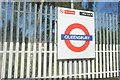
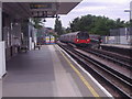
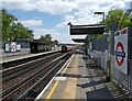
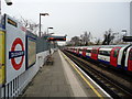
3
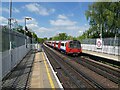
Arrival at Queensbury Railway Station
Image: © Roger Cornfoot
Taken: 5 May 2022
0.06 miles
6
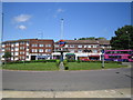
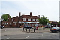
Queensbury Circus
A London Transport roundel sign is in the centre of this large roundabout outside Image
Image: © Nigel Cox
Taken: 18 May 2007
0.10 miles
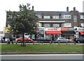
10
Indian restaurant on Honeypot Lane (A4140)
Also known as the Honeypot.
Image: © JThomas
Taken: 3 Aug 2019
0.11 miles