IMAGES TAKEN NEAR TO
Highland Road, NORTHWOOD, HA6 1JU
Introduction
This page details the photographs taken nearby to Highland Road, HA6 1JU by members of the Geograph project.
The Geograph project started in 2005 with the aim of publishing, organising and preserving representative images for every square kilometre of Great Britain, Ireland and the Isle of Man.

There are currently over 7.5m images from over14,400 individuals and you can help contribute to the project by visiting https://www.geograph.org.uk
Image Map
Images are licensed for reuse under creativecommons.org/licenses/by-sa/2.0
Notes
- Clicking on the map will re-center to the selected point.
- The higher the marker number, the further away the image location is from the centre of the postcode.
Image Listing (74 Images Found)
Images are licensed for reuse under creativecommons.org/licenses/by-sa/2.0
Image
Details
Distance
3
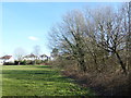
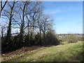
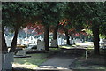
Field at the foot of Haste Hill
Haste Hill is part of an open space to the west of Northwood Hills and would be one of the hills after which Northwood Hills is named - see also https://www.geograph.org.uk/photo/5667907 It slopes down to the west to Haste Hill Golf Course and to the south-west to Ruislip Woods National Nature Reserve. Most of the paths are fairly informal although there is one good path which crosses the top of the hill but then as it reaches the bottom of the northern slope it peters out into what at the time I visited was this very muddy field. There is a ditch beyond the hegdgeline on the right and the slope up to the top of Haste Hill is beyond this. The houses ahead are in Highland Road.
Image: © Marathon
Taken: 21 Mar 2018
0.07 miles
4
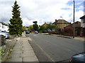
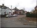
Winchester Road at the corner of York Road
Image: © David Howard
Taken: 2 Dec 2015
0.09 miles
5
Winchester Road at the corner of York Road
Image: © David Howard
Taken: 2 Dec 2015
0.09 miles
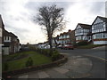
6
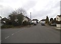
Near the top of Haste Hill
Haste Hill is part of an open space to the west of Northwood Hills and would be one of the hills after which Northwood Hills is named - see also https://www.geograph.org.uk/photo/5667907 It slopes down to the west to Haste Hill Golf Course and to the south-west to Ruislip Woods National Nature Reserve. Most of the paths are fairly informal although there is one good path which crosses the top of the hill but then as it reaches the northern slope here it peters out into what at the time I visited was a very muddy field. Oxhey Wood is on the horizon in the distance.
Image: © Marathon
Taken: 21 Mar 2018
0.10 miles
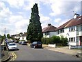
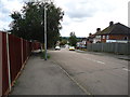
10
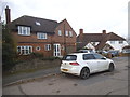
Houses on Cranbourne Road, Northwood Hills
Image: © David Howard
Taken: 2 Dec 2015
0.13 miles