IMAGES TAKEN NEAR TO
High Street, NORTHWOOD, HA6 1ED
Introduction
This page details the photographs taken nearby to High Street, HA6 1ED by members of the Geograph project.
The Geograph project started in 2005 with the aim of publishing, organising and preserving representative images for every square kilometre of Great Britain, Ireland and the Isle of Man.

There are currently over 7.5m images from over14,400 individuals and you can help contribute to the project by visiting https://www.geograph.org.uk
Image Map
Images are licensed for reuse under creativecommons.org/licenses/by-sa/2.0
Notes
- Clicking on the map will re-center to the selected point.
- The higher the marker number, the further away the image location is from the centre of the postcode.
Image Listing (27 Images Found)
Images are licensed for reuse under creativecommons.org/licenses/by-sa/2.0
Image
Details
Distance
1
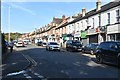
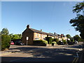
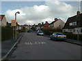
Junction of High Street and Emmanuel Road
Image: © Basher Eyre
Taken: 12 Aug 2016
0.03 miles
2
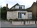
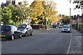
Northwood Dining Club or previously Ritz cinema
Was a cinema in the High Street Northwood now due to be demolished.
Image: © pearl gardner
Taken: 13 Jul 2007
0.04 miles
4
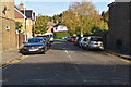
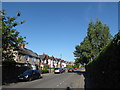
Junction of High Street and Chester Road
Image: © Basher Eyre
Taken: 12 Aug 2016
0.06 miles
7
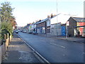
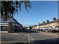
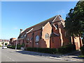
Northwood: High Street
Community shops, viewed looking northwards from the junction with the A404 Pinner Road.
Image: © Nigel Cox
Taken: 20 Nov 2005
0.14 miles