IMAGES TAKEN NEAR TO
Rayners Lane, PINNER, HA5 5HY
Introduction
This page details the photographs taken nearby to Rayners Lane, HA5 5HY by members of the Geograph project.
The Geograph project started in 2005 with the aim of publishing, organising and preserving representative images for every square kilometre of Great Britain, Ireland and the Isle of Man.

There are currently over 7.5m images from over14,400 individuals and you can help contribute to the project by visiting https://www.geograph.org.uk
Image Map
Images are licensed for reuse under creativecommons.org/licenses/by-sa/2.0
Notes
- Clicking on the map will re-center to the selected point.
- The higher the marker number, the further away the image location is from the centre of the postcode.
Image Listing (32 Images Found)
Images are licensed for reuse under creativecommons.org/licenses/by-sa/2.0
Image
Details
Distance
3
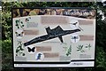
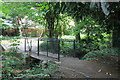
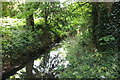
Sign at the entrance to Yeading Walk, Harrow
Image: © David Howard
Taken: 21 May 2020
0.03 miles


10
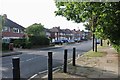
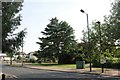
Roundabout on Rayners Lane
The road, from which Rayners Lane Underground station takes its name, runs north from the station to Pinner. This view of a roundabout on Rayners Lane is taken from Church Avenue. Whittington Way is the next road to the left, followed by Rayners Lane, Suffolk Road and finally Rayners Lane again.
Image: © Marathon
Taken: 27 Apr 2016
0.05 miles