IMAGES TAKEN NEAR TO
Woodhall Gate, PINNER, HA5 4TZ
Introduction
This page details the photographs taken nearby to Woodhall Gate, HA5 4TZ by members of the Geograph project.
The Geograph project started in 2005 with the aim of publishing, organising and preserving representative images for every square kilometre of Great Britain, Ireland and the Isle of Man.

There are currently over 7.5m images from over14,400 individuals and you can help contribute to the project by visiting https://www.geograph.org.uk
Image Map
Images are licensed for reuse under creativecommons.org/licenses/by-sa/2.0
Notes
- Clicking on the map will re-center to the selected point.
- The higher the marker number, the further away the image location is from the centre of the postcode.
Image Listing (22 Images Found)
Images are licensed for reuse under creativecommons.org/licenses/by-sa/2.0
Image
Details
Distance
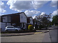
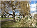
2
Scot Grove, Hatch End
Scot Grove is clearly a recent housing estate on the very edge of the built-up area of Pinner and Hatch End. It is built around a central green.
Image: © Marathon
Taken: 7 Mar 2018
0.08 miles
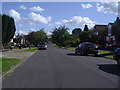
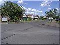
3
Scot Grove, Hatch End
Scot Grove is clearly a recent housing estate on the very edge of the built-up area of Pinner and Hatch End.
Image: © Marathon
Taken: 7 Mar 2018
0.08 miles
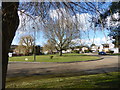
8
Albury Drive, Pinner
Looking along the cul de sac part
Image: © David Howard
Taken: 19 Jun 2008
0.12 miles