1
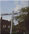
Direction Sign - Signpost by the A404 Uxbridge Road, Pinner
Nipple finial - 2 arms; Middlesex CC iron by the A404, formerly the A410, in parish of Pinner (Harrow District), Uxbridge Road junction with Woodhall Drive.
Surveyed
Milestone Society National ID: MX_TQ1290
Image: © C Woodward
Taken: 9 Sep 2007
0.11 miles
2
Uxbridge Road, Pinner
Image: © David Howard
Taken: 4 Feb 2009
0.11 miles
3
Pinner - Poplar Close
Image: © Peter Whatley
Taken: 2 Apr 2012
0.13 miles
4
Lodge at end of Old Hall Drive
A remnant from the days there was an Old Hall at the other end of the drive. It was snowing lightly, strangely neither noticeably settling on the ground nor wetting it.
Image: © Robin Webster
Taken: 23 Feb 2013
0.15 miles
5
Brook south of Uxbridge Road
It does not seem to have a name. The Thames Water monitoring point here is called Waxwell Lane, not very close here, but the brook does eventually run along the bottom of the long back gardens of houses in that road.
Image: © Robin Webster
Taken: 23 Feb 2013
0.17 miles
6
Evelyn Drive, Pinnerwood Park
Pinner is often seen as the epitome of Metroland but there was an original village there long before all the later 1930s housing came in - see https://www.geograph.org.uk/photo/4928777 As would be expected John Betjeman, the main authority on Metroland, included Pinner in one of his poems - "The Metropolitan Railway - Baker Street buffet" has the verse:
"Early electric! Sit you down and see
'Mid this fine woodwork and a smell of dinner,
A stained-glass windmill and a pot of tea,
The sepia view of leafy lanes in PINNER
Then visualize, far down the shining lines,
Your parents' homestead set in murmuring pines."
This is looking along Evelyn Drive in Pinnerwood Park. Many of the houses in this area of Pinner appear to be post-war.
Image: © Marathon
Taken: 7 Mar 2018
0.18 miles
7
Uxbridge Road by St Thomas Drive bus stop
The stop is served by route H12 from South Harrow station to Stanmore station.
Image: © Robin Webster
Taken: 23 Feb 2013
0.20 miles
8
Pinnerwood Park
Pinner is often seen as the epitome of Metroland but there was an original village there long before all the later 1930s housing came in - see https://www.geograph.org.uk/photo/4928777 As would be expected John Betjeman, the main authority on Metroland, included Pinner in one of his poems - "The Metropolitan Railway - Baker Street buffet" has the verse:
"Early electric! Sit you down and see
'Mid this fine woodwork and a smell of dinner,
A stained-glass windmill and a pot of tea,
The sepia view of leafy lanes in PINNER
Then visualize, far down the shining lines,
Your parents' homestead set in murmuring pines."
This is looking across Albury Drive towards Evelyn Drive in Pinnerwood Park. Many of the houses in this area of Pinner appear to be post-war.
Image: © Marathon
Taken: 7 Mar 2018
0.21 miles
9
Evelyn Drive, Hatch End
Evelyn Drive is on the very edge of the built-up area of Pinner and Hatch End.
Image: © Marathon
Taken: 7 Mar 2018
0.23 miles


