IMAGES TAKEN NEAR TO
St. Thomas Drive, PINNER, HA5 4SS
Introduction
This page details the photographs taken nearby to St. Thomas Drive, HA5 4SS by members of the Geograph project.
The Geograph project started in 2005 with the aim of publishing, organising and preserving representative images for every square kilometre of Great Britain, Ireland and the Isle of Man.

There are currently over 7.5m images from over14,400 individuals and you can help contribute to the project by visiting https://www.geograph.org.uk
Image Map
Images are licensed for reuse under creativecommons.org/licenses/by-sa/2.0
Notes
- Clicking on the map will re-center to the selected point.
- The higher the marker number, the further away the image location is from the centre of the postcode.
Image Listing (22 Images Found)
Images are licensed for reuse under creativecommons.org/licenses/by-sa/2.0
Image
Details
Distance

2

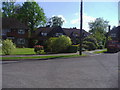
St Thomas Drive, junction of Old Hall Close
Image: © David Howard
Taken: 1 May 2009
0.08 miles

6

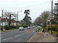
Wellington Road, Hatch End
Although the green and the yellow blocks look similar the absence of chimneys on the yellow block imply it was built about a century later than the green Victorian one. It's a residential home and appears to have been a poor copy of the original house next door.
Image: © David Howard
Taken: 2 Dec 2015
0.16 miles


10
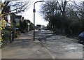
Uxbridge Road by St Thomas Drive bus stop
The stop is served by route H12 from South Harrow station to Stanmore station.
Image: © Robin Webster
Taken: 23 Feb 2013
0.20 miles