IMAGES TAKEN NEAR TO
The Lawns, PINNER, HA5 4BJ
Introduction
This page details the photographs taken nearby to The Lawns, HA5 4BJ by members of the Geograph project.
The Geograph project started in 2005 with the aim of publishing, organising and preserving representative images for every square kilometre of Great Britain, Ireland and the Isle of Man.

There are currently over 7.5m images from over14,400 individuals and you can help contribute to the project by visiting https://www.geograph.org.uk
Image Map
Images are licensed for reuse under creativecommons.org/licenses/by-sa/2.0
Notes
- Clicking on the map will re-center to the selected point.
- The higher the marker number, the further away the image location is from the centre of the postcode.
Image Listing (37 Images Found)
Images are licensed for reuse under creativecommons.org/licenses/by-sa/2.0
Image
Details
Distance
3
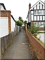
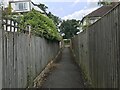
Alleyway between The Lawns and Oxhey Lane
Image: © Bryn Holmes
Taken: 14 Jul 2017
0.06 miles
4
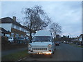
1972 Ford Transit on Rowlands Avenue, Hatch End
The registration is from Hull
Image: © David Howard
Taken: 2 Dec 2015
0.07 miles
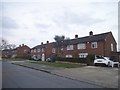
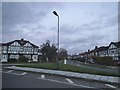
5
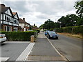
Service Road along Oxhey Lane
The houses have their own road running alongside the main road
Image: © David Howard
Taken: 2 Dec 2015
0.07 miles
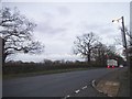
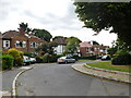
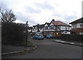
6
The Lawns at the junction of Rowlands Avenue
Image: © David Howard
Taken: 2 Dec 2015
0.08 miles