IMAGES TAKEN NEAR TO
Elm Park Road, PINNER, HA5 3LA
Introduction
This page details the photographs taken nearby to Elm Park Road, HA5 3LA by members of the Geograph project.
The Geograph project started in 2005 with the aim of publishing, organising and preserving representative images for every square kilometre of Great Britain, Ireland and the Isle of Man.

There are currently over 7.5m images from over14,400 individuals and you can help contribute to the project by visiting https://www.geograph.org.uk
Image Map
Images are licensed for reuse under creativecommons.org/licenses/by-sa/2.0
Notes
- Clicking on the map will re-center to the selected point.
- The higher the marker number, the further away the image location is from the centre of the postcode.
Image Listing (83 Images Found)
Images are licensed for reuse under creativecommons.org/licenses/by-sa/2.0
Image
Details
Distance
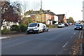
5
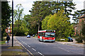
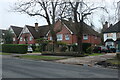
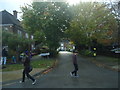
Elm Park Road
Tree lined with apartment blocks and housing estates set well back from the road.
Image: © Martin Addison
Taken: 12 Sep 2009
0.06 miles
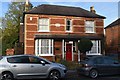
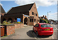
6
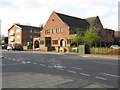
Pinner - Christian Science church, Park Road
Image: © Peter Whatley
Taken: 2 Apr 2012
0.06 miles
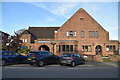
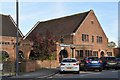
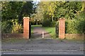
9
Pinner Christian Science Church
Located at the top of the hill above the town centre on Elm Park Road.
Image: © Martin Addison
Taken: 12 Sep 2009
0.06 miles