IMAGES TAKEN NEAR TO
Caulfield Gardens, PINNER, HA5 3GY
Introduction
This page details the photographs taken nearby to Caulfield Gardens, HA5 3GY by members of the Geograph project.
The Geograph project started in 2005 with the aim of publishing, organising and preserving representative images for every square kilometre of Great Britain, Ireland and the Isle of Man.

There are currently over 7.5m images from over14,400 individuals and you can help contribute to the project by visiting https://www.geograph.org.uk
Image Map
Images are licensed for reuse under creativecommons.org/licenses/by-sa/2.0
Notes
- Clicking on the map will re-center to the selected point.
- The higher the marker number, the further away the image location is from the centre of the postcode.
Image Listing (51 Images Found)
Images are licensed for reuse under creativecommons.org/licenses/by-sa/2.0
Image
Details
Distance
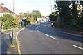
1
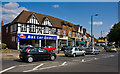
Pinner Green
1950's shops with a service road in front. Traffic can be quite slow here with the B466 joining from the right, a second mini-roundabout serving a superstore and, just around the corner, the traffic lights at the junction with Elm Park Road.
Image: © Martin Addison
Taken: 12 Sep 2009
0.09 miles
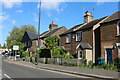
2
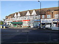
Pinner Green
Community shops on the A404 Pinner Green, viewed looking northwards.
Image: © Nigel Cox
Taken: 20 Nov 2005
0.10 miles
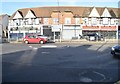
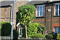
4
Caulfield Gardens, Pinner Green
This was called Mill Farm Close a year ago, but once the road was extended to a new housing estate it changed its name.
Image: © David Howard
Taken: 2 Dec 2015
0.11 miles
5
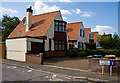
Housing on Rickmansworth Road
Interesting style of detached houses beside Wynlie Gardens, almost like bungalows with additional roof space. There are 5 in total.
Image: © Martin Addison
Taken: 12 Sep 2009
0.11 miles
8
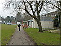
Path, Montesole Playing Fields
Passing in front of the Pinner Cricket Club pavilion.
Image: © Robin Webster
Taken: 23 Feb 2013
0.13 miles
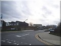
10
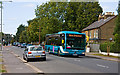
Rickmansworth Road
A rail replacement service makes its way along this straight stretch of the A404.
Image: © Martin Addison
Taken: 12 Sep 2009
0.13 miles