IMAGES TAKEN NEAR TO
Lime Close, PINNER, HA5 2NU
Introduction
This page details the photographs taken nearby to Lime Close, HA5 2NU by members of the Geograph project.
The Geograph project started in 2005 with the aim of publishing, organising and preserving representative images for every square kilometre of Great Britain, Ireland and the Isle of Man.

There are currently over 7.5m images from over14,400 individuals and you can help contribute to the project by visiting https://www.geograph.org.uk
Image Map
Images are licensed for reuse under creativecommons.org/licenses/by-sa/2.0
Notes
- Clicking on the map will re-center to the selected point.
- The higher the marker number, the further away the image location is from the centre of the postcode.
Image Listing (36 Images Found)
Images are licensed for reuse under creativecommons.org/licenses/by-sa/2.0
Image
Details
Distance
1
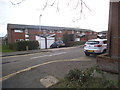
Lime Close
One of several new residential roads off Wiltshire Lane on the site of the former St Vincent's Farm.
Image: © David Squire
Taken: 11 Dec 2005
0.03 miles

3
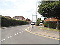
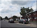
Fore Street at the junction of Wiltshire Lane
Image: © David Howard
Taken: 17 Jul 2014
0.06 miles


9
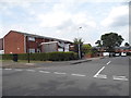
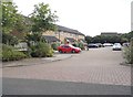
Wylchin Close at the junction of Fore Street
Image: © David Howard
Taken: 17 Jul 2014
0.10 miles