IMAGES TAKEN NEAR TO
Mount Park Road, PINNER, HA5 2JP
Introduction
This page details the photographs taken nearby to Mount Park Road, HA5 2JP by members of the Geograph project.
The Geograph project started in 2005 with the aim of publishing, organising and preserving representative images for every square kilometre of Great Britain, Ireland and the Isle of Man.

There are currently over 7.5m images from over14,400 individuals and you can help contribute to the project by visiting https://www.geograph.org.uk
Image Map
Images are licensed for reuse under creativecommons.org/licenses/by-sa/2.0
Notes
- Clicking on the map will re-center to the selected point.
- The higher the marker number, the further away the image location is from the centre of the postcode.
Image Listing (14 Images Found)
Images are licensed for reuse under creativecommons.org/licenses/by-sa/2.0
Image
Details
Distance
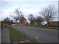
1
Joel Street from the end of Wiltshire Lane
Image: © David Howard
Taken: 2 Dec 2015
0.18 miles
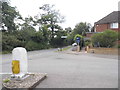
2
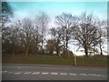
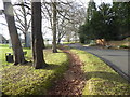
Southill Lane
Southill Lane still has the feel of the old country lane which it once was. It runs between High Road Eastcote and Joel Street with Haydon Hall Park on the left.
Image: © Marathon
Taken: 31 Jan 2018
0.22 miles
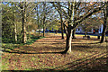
3
Path to the river Pinn
This view is from High Road Eastcote. The path on the left crosses the River Pinn just ahead. The River Pinn is a tributary of the Frays River which it joins at Yiewsley after passing through Ickenham and Uxbridge.
Image: © Marathon
Taken: 31 Jan 2018
0.22 miles
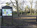
4
Along the Celandine Route in Eastcote
The Celandine Route follows the River Pinn between Pinner and Uxbridge. This is beside Eastcote High Road.
Image: © Des Blenkinsopp
Taken: 13 Nov 2018
0.22 miles
5
Southill Lane
Southill Lane still has the feel of the old country lane which it once was. It runs between High Road Eastcote and Joel Street with Haydon Hall Park on the left.
Image: © Marathon
Taken: 31 Jan 2018
0.22 miles
6
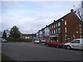
Shops on Salisbury Road, Northwood Hills
Image: © David Howard
Taken: 2 Dec 2015
0.22 miles
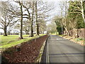
7
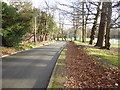
Southill Lane
Southill Lane still has the feel of the old country lane which it once was. It runs between Joel Street and High Road Eastcote with Haydon Hall Park on the right here.
Image: © Marathon
Taken: 31 Jan 2018
0.22 miles
8
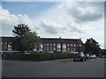
Shops on Salisbury Road, Northwood Hills
Image: © David Howard
Taken: 17 Jul 2014
0.23 miles
10
Salisbury Road at the junction of Fore Street
Image: © David Howard
Taken: 17 Jul 2014
0.24 miles