IMAGES TAKEN NEAR TO
Field End Road, RUISLIP, HA4 9PQ
Introduction
This page details the photographs taken nearby to Field End Road, HA4 9PQ by members of the Geograph project.
The Geograph project started in 2005 with the aim of publishing, organising and preserving representative images for every square kilometre of Great Britain, Ireland and the Isle of Man.

There are currently over 7.5m images from over14,400 individuals and you can help contribute to the project by visiting https://www.geograph.org.uk
Image Map
Images are licensed for reuse under creativecommons.org/licenses/by-sa/2.0
Notes
- Clicking on the map will re-center to the selected point.
- The higher the marker number, the further away the image location is from the centre of the postcode.
Image Listing (25 Images Found)
Images are licensed for reuse under creativecommons.org/licenses/by-sa/2.0
Image
Details
Distance
1
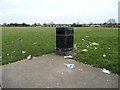
Litter bin and litter, Field End Road Recreation Ground
Not sure if people have been careless, or animals clever.
Image: © Christine Johnstone
Taken: 8 Mar 2016
0.10 miles
2
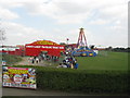
Funderpark or Thunderpark?
Whatever the name, there was a sizeable queue to access the funfair.
Image: © Peter Whatley
Taken: 2 Apr 2012
0.12 miles
3
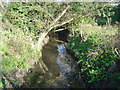
Yeading Brook, Eastcote
Viewed looking upstream from the Field End Road bridge.
Image: © Nigel Cox
Taken: 20 Nov 2005
0.13 miles
4
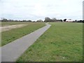
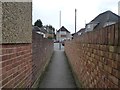
Path crossing Field End Road Recreation Ground
This is public footpath R171, linking Field End Road and Yeading Avenue.
Image: © Christine Johnstone
Taken: 8 Mar 2016
0.13 miles
5
Public footpath approaching Mount Pleasant
Connecting St Andrew's Close and Mount Pleasant, across Yeading Brook.
Image: © Christine Johnstone
Taken: 8 Mar 2016
0.14 miles
6
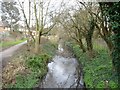
Yeading Brook
Looking north-east [upstream] from the public footpath footbridge.
Image: © Christine Johnstone
Taken: 8 Mar 2016
0.15 miles
7
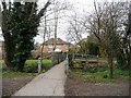
Footbridge over Yeading Brook
Carrying the public footpath from Mount Pleasant to St Andrew's Close.
Image: © Christine Johnstone
Taken: 8 Mar 2016
0.16 miles
8
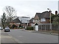
Raising the roof on Oxford Drive
Probably another loft conversion.
Image: © Christine Johnstone
Taken: 8 Mar 2016
0.18 miles
9
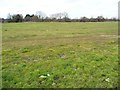
Field End Road Recreation Ground
Looking north-west from the public footpath towards the trees alongside Yeading Brook.
Image: © Christine Johnstone
Taken: 8 Mar 2016
0.18 miles
10
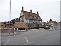
Venue 5, Field End Road
A restaurant and banqueting suite serving Indian and Indian-Chinese fusion food. Here since 2003. The building was formerly the Clay Pigeon pub.
Image: © Christine Johnstone
Taken: 8 Mar 2016
0.19 miles