IMAGES TAKEN NEAR TO
St. James Close, RUISLIP, HA4 9EQ

Introduction

This page details the photographs taken nearby to St. James Close, HA4 9EQ by members of the Geograph project.

The Geograph project started in 2005 with the aim of publishing, organising and preserving representative images for every square kilometre of Great Britain, Ireland and the Isle of Man.

There are currently over 7.5m images from over14,400 individuals and you can help contribute to the project by visiting https://www.geograph.org.uk

Image Map


Images are licensed for reuse under creativecommons.org/licenses/by-sa/2.0
Notes
  • Clicking on the map will re-center to the selected point.
  • The higher the marker number, the further away the image location is from the centre of the postcode.

Image Listing (35 Images Found)

Images are licensed for reuse under creativecommons.org/licenses/by-sa/2.0
  • ...
Image
Details
Distance
1
Collins Drive, closed for resurfacing
On the north side of Whitby Road.
Image: © Christine Johnstone Taken: 8 Mar 2016
0.08 miles
2
Ferncroft Avenue
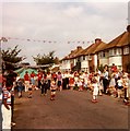
I took this picture at the Queen's Silver Jubilee party in June 1977. This picture is taken from opposite No. 41 Ferncroft Avenue.
Image: © Nick Mutton 01329 000000 Taken: 1 Jun 1977
0.12 miles
3
Houses on the north side of Whitby Road
The housing along this street is a mixture of semi-detached houses and low blocks of four flats.
Image: © Christine Johnstone Taken: 8 Mar 2016
0.12 miles
4
Raising the roof on Oxford Drive
Probably another loft conversion.
Image: © Christine Johnstone Taken: 8 Mar 2016
0.13 miles
5
Bungalows on Field End Road
Image: © Peter Whatley Taken: 2 Apr 2012
0.14 miles
6
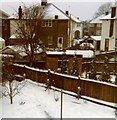
Ferncroft Avenue in the snow
This was a period of heavy snow in December 1981.
Image: © Nick Mutton 01329 000000 Taken: 1 Dec 1981
0.14 miles
7
Whitby Parade, Whitby Road
At least nine businesses, including shops, a betting shop and a restaurant.
Image: © Christine Johnstone Taken: 8 Mar 2016
0.14 miles
8
Pavilion Way houses
Took picture from back bedroom of No. 16 Ferncroft Avenue in December 1981
Image: © Nick Mutton 01329 000000 Taken: 1 Dec 1981
0.14 miles
9
Queens Walk at the junction of Whitby Road
Image: © David Howard Taken: 24 Jul 2012
0.14 miles
10
Footbridge over Yeading Brook
Carrying the public footpath from Mount Pleasant to St Andrew's Close.
Image: © Christine Johnstone Taken: 8 Mar 2016
0.15 miles
  • ...