IMAGES TAKEN NEAR TO
Beverley Road, RUISLIP, HA4 9AS
Introduction
This page details the photographs taken nearby to Beverley Road, HA4 9AS by members of the Geograph project.
The Geograph project started in 2005 with the aim of publishing, organising and preserving representative images for every square kilometre of Great Britain, Ireland and the Isle of Man.

There are currently over 7.5m images from over14,400 individuals and you can help contribute to the project by visiting https://www.geograph.org.uk
Image Map
Images are licensed for reuse under creativecommons.org/licenses/by-sa/2.0
Notes
- Clicking on the map will re-center to the selected point.
- The higher the marker number, the further away the image location is from the centre of the postcode.
Image Listing (16 Images Found)
Images are licensed for reuse under creativecommons.org/licenses/by-sa/2.0
Image
Details
Distance
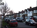
4
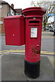
George VI postbox on Victoria Road, Ruislip
Postbox No. HA4 372.
See Image] for context.
Image: © JThomas
Taken: 13 Apr 2019
0.16 miles
5
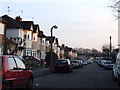
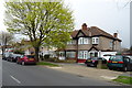
Houses on Victoria Road, Ruislip
Showing position of Postbox No. HA4 372.
See Image] for postbox.
Image: © JThomas
Taken: 13 Apr 2019
0.17 miles
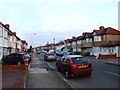
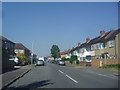
6
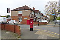
Victoria Road, Ruislip
One of London's longest straight roads.
Image: © David Howard
Taken: 16 Jan 2009
0.19 miles
8
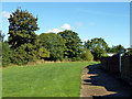
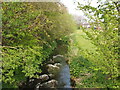
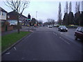
Behind the houses, Torcross Road
Part of the long corridor of open space that follows the Yeading Brook through suburbia. The brook is on the left, lined with trees and bushes.
Image: © Robin Webster
Taken: 6 Oct 2012
0.19 miles