IMAGES TAKEN NEAR TO
Trenchard Avenue, RUISLIP, HA4 6NP
Introduction
This page details the photographs taken nearby to Trenchard Avenue, HA4 6NP by members of the Geograph project.
The Geograph project started in 2005 with the aim of publishing, organising and preserving representative images for every square kilometre of Great Britain, Ireland and the Isle of Man.

There are currently over 7.5m images from over14,400 individuals and you can help contribute to the project by visiting https://www.geograph.org.uk
Image Map
Images are licensed for reuse under creativecommons.org/licenses/by-sa/2.0
Notes
- Clicking on the map will re-center to the selected point.
- The higher the marker number, the further away the image location is from the centre of the postcode.
Image Listing (52 Images Found)
Images are licensed for reuse under creativecommons.org/licenses/by-sa/2.0
Image
Details
Distance
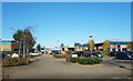
1
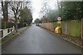
Trenchard Avenue, Ruislip
These roads are RAF housing, and the sign appears to be pre-Worboys although the numbers below 30mph were normally on an oblong plate with the circle above.
Image: © David Howard
Taken: 31 Jan 2021
0.06 miles
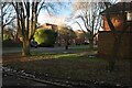
3
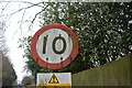
Pre-Worboys speed limit, Ruislip
Normally the numbers below 30mph were on oblong plates but a few were also made in the regular format.
Image: © David Howard
Taken: 31 Jan 2021
0.09 miles
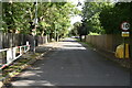
5
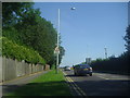
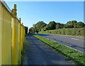
West End Road, Ruislip
Northolt aerodrome is on the right
Image: © David Howard
Taken: 24 Jul 2012
0.09 miles
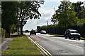
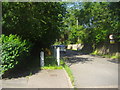
9
A4180 West End Road near RAF Northolt Aerodrome
Image: © Mat Fascione
Taken: 21 Aug 2015
0.12 miles
