IMAGES TAKEN NEAR TO
Cody Close, HARROW, HA3 9ES
Introduction
This page details the photographs taken nearby to Cody Close, HA3 9ES by members of the Geograph project.
The Geograph project started in 2005 with the aim of publishing, organising and preserving representative images for every square kilometre of Great Britain, Ireland and the Isle of Man.

There are currently over 7.5m images from over14,400 individuals and you can help contribute to the project by visiting https://www.geograph.org.uk
Image Map
Images are licensed for reuse under creativecommons.org/licenses/by-sa/2.0
Notes
- Clicking on the map will re-center to the selected point.
- The higher the marker number, the further away the image location is from the centre of the postcode.
Image Listing (47 Images Found)
Images are licensed for reuse under creativecommons.org/licenses/by-sa/2.0
Image
Details
Distance
5
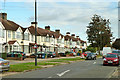
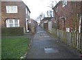
Houses on Charlton Road
Of a typical suburban semi-detached type, but actually built in blocks of six or four.
Image: © Robin Webster
Taken: 13 Oct 2012
0.12 miles
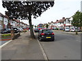
6
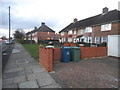
Houses in Kenmore Road
Shows the location of Image
Image: © Mike Quinn
Taken: 21 Aug 2008
0.12 miles
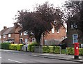
9
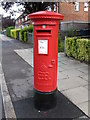
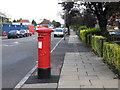
Edward VIII postbox, Kenmore Road / Waghorn Road
Image: © Mike Quinn
Taken: 21 Aug 2008
0.13 miles
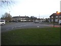
10
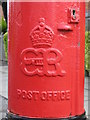
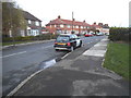
Edward VIII postbox, Kenmore Road / Waghorn Road - royal cipher
See Image
Image: © Mike Quinn
Taken: 21 Aug 2008
0.13 miles