IMAGES TAKEN NEAR TO
Montrose Road, HARROW, HA3 7DY
Introduction
This page details the photographs taken nearby to Montrose Road, HA3 7DY by members of the Geograph project.
The Geograph project started in 2005 with the aim of publishing, organising and preserving representative images for every square kilometre of Great Britain, Ireland and the Isle of Man.

There are currently over 7.5m images from over14,400 individuals and you can help contribute to the project by visiting https://www.geograph.org.uk
Image Map
Images are licensed for reuse under creativecommons.org/licenses/by-sa/2.0
Notes
- Clicking on the map will re-center to the selected point.
- The higher the marker number, the further away the image location is from the centre of the postcode.
Image Listing (10 Images Found)
Images are licensed for reuse under creativecommons.org/licenses/by-sa/2.0
Image
Details
Distance
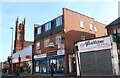
2
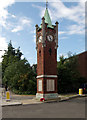
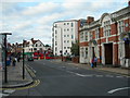
War memorial and clock tower, Wealdstone
At the junction of High Street and Spencer Road.
Image: © Christine Johnstone
Taken: 22 Apr 2015
0.16 miles
4
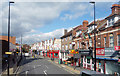
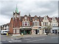
High Street Shops
Wealdstone High Street.
Image: © Des Blenkinsopp
Taken: 2 Oct 2019
0.16 miles
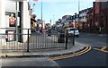
8
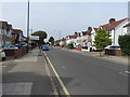
High Street, Wealdstone (2)
At the junction of Gordon Road, Wealdstone Police Station is to the right.
Image: © Danny P Robinson
Taken: 5 Sep 2006
0.24 miles
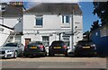
9
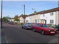
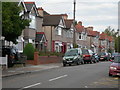
Harrow Weald: The Green Way
Neat blocks of rendered houses, looking north.
Image: © Nigel Cox
Taken: 12 Nov 2005
0.24 miles