IMAGES TAKEN NEAR TO
West Drive, HARROW, HA3 6TU
Introduction
This page details the photographs taken nearby to West Drive, HA3 6TU by members of the Geograph project.
The Geograph project started in 2005 with the aim of publishing, organising and preserving representative images for every square kilometre of Great Britain, Ireland and the Isle of Man.

There are currently over 7.5m images from over14,400 individuals and you can help contribute to the project by visiting https://www.geograph.org.uk
Image Map
Images are licensed for reuse under creativecommons.org/licenses/by-sa/2.0
Notes
- Clicking on the map will re-center to the selected point.
- The higher the marker number, the further away the image location is from the centre of the postcode.
Image Listing (10 Images Found)
Images are licensed for reuse under creativecommons.org/licenses/by-sa/2.0
Image
Details
Distance
3
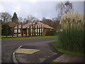
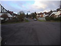
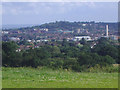
Houses on Bellfield Avenue
London is starting to give way to a more rural landscape around here, with farmland style fields and hedges starting to appear.
Image: © Des Blenkinsopp
Taken: 2 Oct 2019
0.09 miles
4
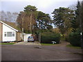
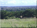
Bentley Priory fields from Bellfield Avenue
Image: © David Howard
Taken: 9 Jan 2014
0.14 miles
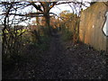
8
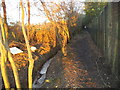
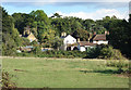
Path from Uxbridge Road to Bentley Priory
The drainage ditch can be seen on the left with playing fields on the other side.
Image: © David Howard
Taken: 9 Jan 2014
0.21 miles
10
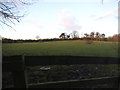
Path from Uxbridge Road to Bentley Priory
They were playing football on the left but behind the trees.
Image: © David Howard
Taken: 9 Jan 2014
0.22 miles