IMAGES TAKEN NEAR TO
Brookshill, HARROW, HA3 6RY
Introduction
This page details the photographs taken nearby to Brookshill, HA3 6RY by members of the Geograph project.
The Geograph project started in 2005 with the aim of publishing, organising and preserving representative images for every square kilometre of Great Britain, Ireland and the Isle of Man.

There are currently over 7.5m images from over14,400 individuals and you can help contribute to the project by visiting https://www.geograph.org.uk
Image Map
Images are licensed for reuse under creativecommons.org/licenses/by-sa/2.0
Notes
- Clicking on the map will re-center to the selected point.
- The higher the marker number, the further away the image location is from the centre of the postcode.
Image Listing (16 Images Found)
Images are licensed for reuse under creativecommons.org/licenses/by-sa/2.0
Image
Details
Distance
1
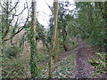
Footpath from Brook Hill to Clamp Hill
The depressed area to the left seems to have been a brick field.
Image: © Robin Webster
Taken: 23 Feb 2013
0.12 miles
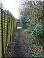
2
Footpath from Brook Hill to Clamp Hill
Image: © Robin Webster
Taken: 23 Feb 2013
0.12 miles
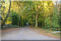
3
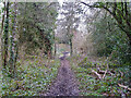
Footpath from Clamp Hill to Brook Hill
Image: © Robin Webster
Taken: 23 Feb 2013
0.12 miles
4
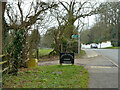
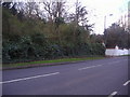
Start of drive to Lower Priory Farm
It is also a footpath, according to the sign a "Public footpath to Bentley Priory Circular Walk".
Image: © Robin Webster
Taken: 23 Feb 2013
0.14 miles
5

Footpath from Clamp Hill to Brook Hill
Image: © Robin Webster
Taken: 23 Feb 2013
0.14 miles
6
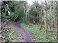
Footpath from Brook Hill to Clamp Hill
Image: © Robin Webster
Taken: 23 Feb 2013
0.14 miles
7
London Borough of Harrow : Driveway
Looking along a driveway off of Clamp Hill.
Image: © Lewis Clarke
Taken: 3 Oct 2018
0.15 miles
8
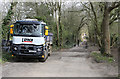
Track to Lower Priory Farm
Looking along the track which leads to riding stables from Clamp Hill (buildings just visible in the distance). The truck parked here was present for works being carried out in the adjacent grounds of Bentley Wood High School. Next to the truck are some black sileage bundles, presumably for the stables.
Image: © Martin Addison
Taken: 8 Apr 2015
0.17 miles
9
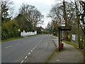
Bentleywood High School bus stop
On Clamp Hill, served only by the school service route 640 according to the sign.
Image: © Robin Webster
Taken: 23 Feb 2013
0.17 miles