IMAGES TAKEN NEAR TO
Alexandra Avenue, HARROW, HA2 9UQ
Introduction
This page details the photographs taken nearby to Alexandra Avenue, HA2 9UQ by members of the Geograph project.
The Geograph project started in 2005 with the aim of publishing, organising and preserving representative images for every square kilometre of Great Britain, Ireland and the Isle of Man.

There are currently over 7.5m images from over14,400 individuals and you can help contribute to the project by visiting https://www.geograph.org.uk
Image Map (Loading...)


Getting Data...Please wait
Leaflet Map data © OpenStreetMap
Images are licensed for reuse under creativecommons.org/licenses/by-sa/2.0
Notes
- Clicking on the map will re-center to the selected point.
- The higher the marker number, the further away the image location is from the centre of the postcode.
Image Listing (20 Images Found)
Images are licensed for reuse under creativecommons.org/licenses/by-sa/2.0
Image
Details
Distance
1
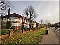
South Harrow - Alexandra Avenue
Apartment block on main road the A4090.
Image: © James Emmans
Taken: 20 Nov 2019
0.02 miles
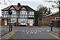
3
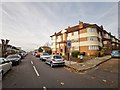
1950's Block of Flats
On the corner of Capthorne Avenue and Alexandra Avenue.
Image: © James Emmans
Taken: 20 Nov 2019
0.06 miles
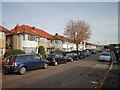
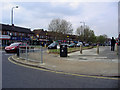
4
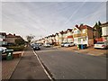
Alexandra Avenue from corner of Rayner's Lane
Image: © David Howard
Taken: 22 Apr 2008
0.10 miles
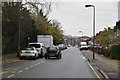
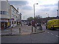
9
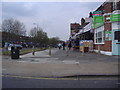
Shops along Alexandra Avenue, Rayner's Lane
Image: © David Howard
Taken: 22 Apr 2008
0.14 miles
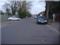
10
Alexandra Avenue from corner of Rayner's Lane
Image: © David Howard
Taken: 22 Apr 2008
0.17 miles