IMAGES TAKEN NEAR TO
Eastcote Lane, HARROW, HA2 9AL
Introduction
This page details the photographs taken nearby to Eastcote Lane, HA2 9AL by members of the Geograph project.
The Geograph project started in 2005 with the aim of publishing, organising and preserving representative images for every square kilometre of Great Britain, Ireland and the Isle of Man.

There are currently over 7.5m images from over14,400 individuals and you can help contribute to the project by visiting https://www.geograph.org.uk
Image Map (Loading...)


Getting Data...Please wait
Leaflet Map data © OpenStreetMap
Images are licensed for reuse under creativecommons.org/licenses/by-sa/2.0
Notes
- Clicking on the map will re-center to the selected point.
- The higher the marker number, the further away the image location is from the centre of the postcode.
Image Listing (39 Images Found)
Images are licensed for reuse under creativecommons.org/licenses/by-sa/2.0
Image
Details
Distance
1
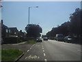
Eastcote Lane, Northolt
Ivy Close is on the left
Image: © David Howard
Taken: 24 Jul 2012
0.04 miles
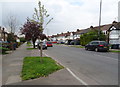
4
Houses on the east side of Field End Road
In blocks of four, facing a parade of shops.
Image: © Christine Johnstone
Taken: 8 Mar 2016
0.14 miles
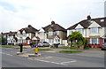
5
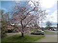
Green alongside Field End Road
The roundabout where Field End Road meets Eastcote Lane and Victoria Road is just past the petrol station. The Roxbourne river is just behind where I am standing.
Image: © Marathon
Taken: 13 Apr 2016
0.14 miles
6
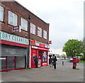
Post Office on Eastcote Lane, Harrow
Showing position of Postbox No. HA2 293.
See Image] for postbox.
Image: © JThomas
Taken: 13 Apr 2019
0.15 miles
7
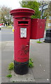
George V postbox on Eastcote Lane, Harrow
Outside the Post Office.
Postbox No. HA2 293.
See Image] for context.
Image: © JThomas
Taken: 13 Apr 2019
0.15 miles
8
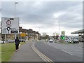
Approaching a roundabout on Field End Road
The yellow notice encourages people to drive safely. The number of casualties here has dropped over consecutive three-year periods.
Image: © Christine Johnstone
Taken: 8 Mar 2016
0.16 miles
9
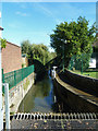
The Roxbourne
Just above screens at the inlet to a culverted section about 1 km long, on its way to augment the waters of the Yeading Brook.
Image: © Robin Webster
Taken: 6 Oct 2012
0.16 miles
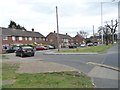
10
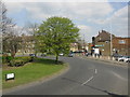
Roundabout intersection
Looking toward the post office on Eastcote Lane from Field End Road.
Image: © Peter Whatley
Taken: 2 Apr 2012
0.16 miles