IMAGES TAKEN NEAR TO
Imperial Drive, HARROW, HA2 7HW
Introduction
This page details the photographs taken nearby to Imperial Drive, HA2 7HW by members of the Geograph project.
The Geograph project started in 2005 with the aim of publishing, organising and preserving representative images for every square kilometre of Great Britain, Ireland and the Isle of Man.

There are currently over 7.5m images from over14,400 individuals and you can help contribute to the project by visiting https://www.geograph.org.uk
Image Map
Images are licensed for reuse under creativecommons.org/licenses/by-sa/2.0
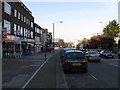
Notes
- Clicking on the map will re-center to the selected point.
- The higher the marker number, the further away the image location is from the centre of the postcode.
Image Listing (26 Images Found)
Images are licensed for reuse under creativecommons.org/licenses/by-sa/2.0
Image
Details
Distance
2
Elmfield Church, Imperial Drive
Elmfield Church is seen here from the central reservation of Imperial Drive. The church describes itself as "a friendly and growing multi-cultural evangelical church in North Harrow." For more information see http://www.elmfield.org/
Image: © Marathon
Taken: 23 Dec 2015
0.11 miles
3
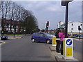
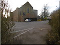
Imperial Drive junction of Village Way
Image: © David Howard
Taken: 22 Apr 2008
0.11 miles
4
St John Fisher Roman Catholic Church, Imperial Drive
St. John Fisher describes itself as "a large, lively Roman Catholic parish in the outer London suburb of Harrow." This photograph is from the corner of Imperial Drive and Imperial Close.
For more information see http://stjohnfisheronline.org.uk/
Image: © Marathon
Taken: 23 Dec 2015
0.13 miles
5
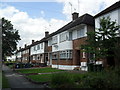
Imperial Close
1930s maisonettes in North Harrow.
Image: © Burgess Von Thunen
Taken: 20 Jun 2012
0.14 miles
6
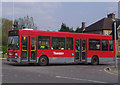
H11 bus leaving The Ridgeway
From Imperial Drive junction
Image: © David Howard
Taken: 22 Apr 2008
0.18 miles
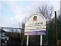
7
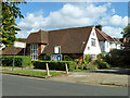
Quaker Meeting House
On Rayners Lane.
Image: © Robin Webster
Taken: 29 Sep 2012
0.18 miles
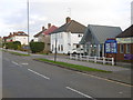
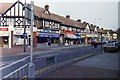
8
Rayners Lane
The road, from which Rayners Lane Underground station takes its name, runs north from the station to Pinner. It is pleasantly tree-lined and at The Close has small greens on either side of the road.
Image: © Marathon
Taken: 27 Apr 2016
0.19 miles
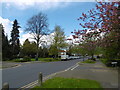
9
Village Way East
Taken from the corner of Rayners Lane
Image: © Carl Grove
Taken: 22 Oct 1990
0.20 miles