IMAGES TAKEN NEAR TO
Grosvenor Avenue, HARROW, HA2 7AN
Introduction
This page details the photographs taken nearby to Grosvenor Avenue, HA2 7AN by members of the Geograph project.
The Geograph project started in 2005 with the aim of publishing, organising and preserving representative images for every square kilometre of Great Britain, Ireland and the Isle of Man.

There are currently over 7.5m images from over14,400 individuals and you can help contribute to the project by visiting https://www.geograph.org.uk
Image Map
Images are licensed for reuse under creativecommons.org/licenses/by-sa/2.0
Notes
- Clicking on the map will re-center to the selected point.
- The higher the marker number, the further away the image location is from the centre of the postcode.
Image Listing (97 Images Found)
Images are licensed for reuse under creativecommons.org/licenses/by-sa/2.0
Image
Details
Distance
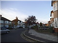
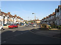
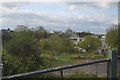
3
Grosvenor Avenue, Harrow
Grosvenor Avenue is a residential street in Harrow, in outer north west London.
Image: © Malc McDonald
Taken: 29 Aug 2015
0.09 miles
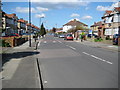
6
Blenheim Road, North Harrow
Blenheim Road is a residential road in outher north west London.
Image: © Malc McDonald
Taken: 29 Aug 2015
0.12 miles
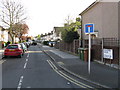
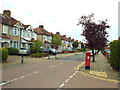
7
Dorchester Avenue, Harrow
Dorchester Avenue is a residential suburban street in outer north west London.
Image: © Malc McDonald
Taken: 29 Aug 2015
0.12 miles
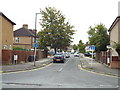
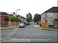
8
North Avenue at the junction of Blenheim Road
Image: © David Howard
Taken: 11 Oct 2014
0.14 miles
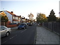
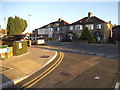
10
North Harrow: Blenheim Road
Until the 1930s this area was just open fields.
Image: © Nigel Cox
Taken: 9 Apr 2008
0.15 miles