
IMAGES TAKEN NEAR TO
Heron Close, FARNHAM, GU9 8WF
Introduction
This page details the photographs taken nearby to Heron Close, GU9 8WF by members of the Geograph project.
The Geograph project started in 2005 with the aim of publishing, organising and preserving representative images for every square kilometre of Great Britain, Ireland and the Isle of Man.

There are currently over 7.5m images from over14,400 individuals and you can help contribute to the project by visiting https://www.geograph.org.uk
Image Map
Images are licensed for reuse under creativecommons.org/licenses/by-sa/2.0
Notes
- Clicking on the map will re-center to the selected point.
- The higher the marker number, the further away the image location is from the centre of the postcode.
Image Listing (9 Images Found)
Images are licensed for reuse under creativecommons.org/licenses/by-sa/2.0
Image
Details
Distance
7
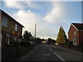
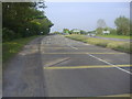
Wrecclesham Road before Farnham
The Coxbridge Roundabout on the A31 is just at the end.
Image: © David Howard
Taken: 14 Oct 2012
0.16 miles
8

Old Milestone by the A325, West Street, Farnham
Carved stone post by the A31, in parish of FARNHAM (WAVERLEY District), West Street by Bushy Reeds Farm, on the verge, back to fence just past the island, on West side of road. Bagshot facet, erected by the Winchester, Upper District (Bagshot to Farnham) turnpike trust in the 19th century.
Inscription reads:-
: Farnham / 1 : : Farnham / LONDON / 39 : : Alton / 8 :
Carved benchmark on left side.
Grade II listed.
List Entry Number: 1258476 https://historicengland.org.uk/listing/the-list/list-entry/1258476
Milestone Society National ID: SY_LWW39.
Image: © L Joseph
Taken: 1 Mar 2005
0.19 miles
9
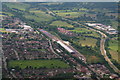
Wrecclesham train repository: aerial 2015
Looking westwards along the A31
No mention on the map of a station name. Maybe it is a refuge for orange and blue caterpillars.
See also Image
Image: © Chris
Taken: 14 Jun 2015
0.20 miles