IMAGES TAKEN NEAR TO
Lynton Close, FARNHAM, GU9 8US
Introduction
This page details the photographs taken nearby to Lynton Close, GU9 8US by members of the Geograph project.
The Geograph project started in 2005 with the aim of publishing, organising and preserving representative images for every square kilometre of Great Britain, Ireland and the Isle of Man.

There are currently over 7.5m images from over14,400 individuals and you can help contribute to the project by visiting https://www.geograph.org.uk
Image Map
Images are licensed for reuse under creativecommons.org/licenses/by-sa/2.0
Notes
- Clicking on the map will re-center to the selected point.
- The higher the marker number, the further away the image location is from the centre of the postcode.
Image Listing (11 Images Found)
Images are licensed for reuse under creativecommons.org/licenses/by-sa/2.0
Image
Details
Distance
1
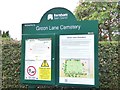
Noticeboard at Green Lane Cemetery, Wrecclesham, Surrey - 180918
Information about the cemetery and chapel.
Image: © John P Reeves
Taken: 18 Sep 2018
0.11 miles
2
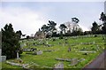
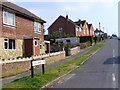
Cemetery, Wrecclesham
Another cemetery across the road from St Peter's church is not far away. This cemetery just has a chapel.
Image: © Robin Webster
Taken: 31 Mar 2007
0.17 miles
3
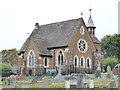
Green Lane Cemetery Chapel, Wrecclesham, Surrey - 180918
Formerly a chapel, now privately owned, seats about 80 people.
Image: © John P Reeves
Taken: 18 Sep 2018
0.19 miles
4
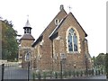
Green Lane Cemetery Chapel, Wrecclesham, Surrey - 180918
Formerly a chapel, now privately owned, seats up to 80 people.
Image: © John P Reeves
Taken: 18 Sep 2018
0.19 miles
5
Little Green Lane, Wrecclesham
A village which has grown, and itself has been caught up in the suburban sprawl of Farnham.
Image: © Colin Smith
Taken: 31 Mar 2007
0.20 miles
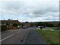
7
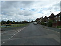
Junction of Beldham and Greenfield Roads
Image: © Basher Eyre
Taken: 31 Jul 2010
0.22 miles
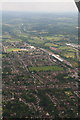
8
Wrecclesham train repository: aerial 2015
Looking westwards along the A31
No mention on the map of a station name. Maybe it is a refuge for orange and blue caterpillars.
See also Image
Image: © Chris
Taken: 14 Jun 2015
0.23 miles
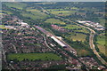
10
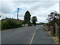
Approaching the junction of Greenfield Road and Beldham Road
Image: © Basher Eyre
Taken: 31 Jul 2010
0.24 miles