
IMAGES TAKEN NEAR TO
Hoe Lane, GUILDFORD, GU5 9SW
Introduction
This page details the photographs taken nearby to Hoe Lane, GU5 9SW by members of the Geograph project.
The Geograph project started in 2005 with the aim of publishing, organising and preserving representative images for every square kilometre of Great Britain, Ireland and the Isle of Man.

There are currently over 7.5m images from over14,400 individuals and you can help contribute to the project by visiting https://www.geograph.org.uk
Image Map
Images are licensed for reuse under creativecommons.org/licenses/by-sa/2.0
Notes
- Clicking on the map will re-center to the selected point.
- The higher the marker number, the further away the image location is from the centre of the postcode.
Image Listing (14 Images Found)
Images are licensed for reuse under creativecommons.org/licenses/by-sa/2.0
Image
Details
Distance
1
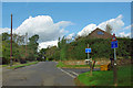
Hoe Lane - unsuitable for HGVs
Hoe Lane is to the right. Straight on and behind the camera are also Hoe Lane!
Image: © Robin Webster
Taken: 18 Oct 2011
0.04 miles
2
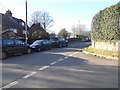
Junction on Hoe Lane, Peaslake
Hoe Lane is one of those annoying Y shaped roads where it's almost impossible for traffic and delivery people to navigate as it's named on more than a single stretch of road.
Image: © David Howard
Taken: 17 Apr 2016
0.05 miles
3
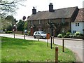
Hoe
A hamlet between Peaslake and Sutton Abinger
Image: © Andrew Longton
Taken: 4 May 2006
0.12 miles

5
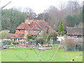
Hoe Farm
Large farm in the Surrey Hills hamlet of Hoe, near Peaslake.
Image: © Colin Smith
Taken: 20 Dec 2011
0.15 miles
6
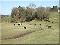
Grazing Cattle
Looking West from the start of Broadfield Road (really an unmetalled track)
Image: © Martyn Davies
Taken: 6 Apr 2006
0.16 miles
7
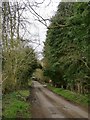
Hoe Lane crossing Hoe Valley
Looking SW, towards the hamlet of Hoe. Behind the camera the lane leads to the old Horsham road (B2126) and the villages of Abinger Hammer and Sutton Abinger. The lane crosses the little valley on a raised embankment.
The turning ahead on the right leads downhill to Hoe Valley Cottage.
Image: © Stefan Czapski
Taken: 30 Mar 2016
0.17 miles
8
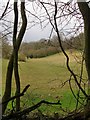
Hoe Valley - seen from Hoe Lane
Even before the leaves come out it is impossible to get an unobstructed view southward along this valley from the road. This was the most open view I could find - the 'frame' of branches isn't there to prettify the picture. As for land-use, grazing here seems to be chiefly for horses.
The lane connecting Sutton Abinger with the hamlet of Hoe is narrow, with steep sections - and a few days after storm Katie there was still a certain amount of debris on the road.
Image: © Stefan Czapski
Taken: 30 Mar 2016
0.18 miles

